Esira | |
|---|---|
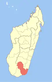
 Esira Location in Madagascar | |
| Coordinates: 24°20′S 46°42′E / 24.333°S 46.700°E | |
| Country | |
| Region | Anosy |
| District | Amboasary Sud |
| Elevation | 469 m (1,539 ft) |
| Population (2001)[2] | |
| • Total | 10,000 |
| Time zone | UTC3 (EAT) |
Esira is a town and commune in Madagascar, in the southern part of the island. It belongs to the district of Amboasary Sud, which is a part of Anosy Region. The population of the commune was estimated to be approximately 10,000 in 2001 commune census.[2]
Primary and junior level secondary education are available in town. The majority 90% of the population of the commune are farmers, while an additional 6% receives their livelihood from raising livestock. The most important crop is rice, while other important products are maize and cassava. Services provide employment for 4% of the population.[2]
References and notes
- ↑ Estimated based on DEM data from Shuttle Radar Topography Mission
- 1 2 3 "ILO census data". Cornell University. 2002. Retrieved 2008-05-04.
Capital: Fort Dauphin (Taolagnaro) | ||
| Amboasary Sud (18) - 603 |
|  |
| Betroka (20) - 613 | ||
| Taolagnaro (24) - 614 | ||
3 districts; 62 communes | ||
This article is issued from Wikipedia. The text is licensed under Creative Commons - Attribution - Sharealike. Additional terms may apply for the media files.