 | |
|---|---|
 | |
| Route information | |
| Length | 5,100 km (3,200 mi) |
| Major junctions | |
| West end | Brest, France |
| East end | |
| Location | |
| Countries | |
| Highway system | |
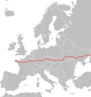
European route E 50 is an A-type east–west connection across the European continent. It connects the key naval port of Brest France with Makhachkala, on the Caspian Sea in the Russian republic Dagestan.
Outlook
Half the route is on highways and the other half is on provincial roads. The route is in estimation some 6,000 kilometres (3,700 mi) long and runs fully across the European continent.
On its way through Europe it crosses several major European routes, such as:
It is one of the longest E roads on the continent.
Since 2014, parts of the road in eastern Ukraine have been under the control of the separatist Donetsk People's Republic and Lugansk People's Republic. During the 2022 Russian invasion of Ukraine, Russia took direct control of the areas in Donbas.
Route
 France
 D 112: Brest (
 E60) - Gouesnou
 N 12: Gouesnou - Saint-Brieuc - Tramain (
 E401) - Rennes
 N 136: Rennes (
 E3)
E3) N 157: Rennes ( E3) - La Gravelle
 A 81: La Gravelle - Laval - Le Mans (
 E501)
E501) A 11: Le Mans ( E501
  E502) - Ablis
 A 10: Ablis (
 E5) - Massy ( E5
  E15)
E15) A 6b: Massy ( E5 E15) - Paris ( E15)
- Boulevard Périphérique: Paris ( E15
 E54)
E54)  A 4: Paris ( E15) - Reims (
 E17
E17  E46
E46  E420) - Châlons-en-Champagne ( E17) - Metz (
 E21
E21  E23
E23  E25) - Freyming-Merlebach ( E25)
 A 320: Freyming-Merlebach ( E25) - Forbach
 Germany
 Czech Republic
 Slovakia
 I/9: Drietoma - Trenčín (
 E572, Start of Concurrency with
  E75 )
E75 ) D1: Trenčín ( E75 E572) - Žilina (
 E442)
E442) D3: Žilina
 I/18: Žilina (End of Concurrency with E75) - Martin
- D1: Martin
- I/18: Martin - Ružomberok (
 E77)
E77) - D1: Ružomberok - Prešov
- I/18: Prešov (
 E371)
E371)  I/20: Prešov
- D1: Prešov - Bidovce
 I/19: Bidovce (
 E58
E58  E71
E71  E571) - Vyšné Nemecké
 Ukraine (Note: since April 2021, M12 and M04 Stryi – Kropyvnytskyi – Debaltseve were combined into M30)[1][2]
 M 08: Uzhhorod border - Uzhhorod (
 E573)
E573) M 06: Uzhhorod ( E573) - Mukachevo (
 E81
E81  E471, End of Concurrency with
  E58) - Stryi ( E471)
 M 12: Stryi ( E471) - Ternopil (
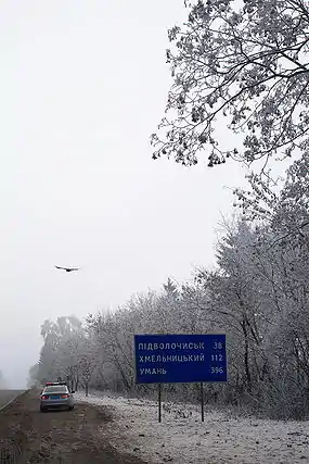
 E85) - Khmelnytskyi - Vinnytsia (
 E583) - Uman (
 E95) - Kropyvnytskyi (
 E584)
E584) M 04: Kropyvnytskyi ( E584) - Oleksandriia ( E584) - Dnipro (
 E105) - Donetsk - Debaltseve (
 E40)
E40) M 03: Debaltseve ( E40) - Dovzhansky
 Russia
 A 270: border with Ukraine - Novoshakhtinsk (Start of concurrency with
 E115)
E115) M 4: Novoshakhtinsk - Rostov-on-Don (
 E58) - Pavlovskaya (End of concurrency with E115)
 R 217: Pavlovskaya ( E115) - Armavir - Mineralnye Vody (
 E117) - Beslan ( E117) - Makhachkala (
 E119)
E119)- Major towns along the R217 highway (Russia) include Kropotkin, Nevinnomyssk, Mineralnye Vody, Pyatigorsk, Nalchik, Beslan, Grozny, Gudermes, Khasavyurt, Makhachkala, and Derbent on the Caspian Sea. After skirting the Greater Caucasus, the route continues to Baku.
References
External links
![]() Geographic data related to European route E50 at OpenStreetMap
Geographic data related to European route E50 at OpenStreetMap