| Flat Creek | |
|---|---|
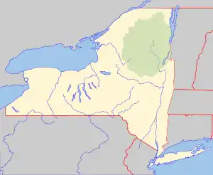 Location of the mouth within New York  Flat Creek (Mohawk River tributary) (the United States) | |
| Native name | Onogerreah |
| Location | |
| Country | United States |
| State | New York |
| Counties | Schoharie, Montgomery |
| Physical characteristics | |
| Source | |
| • location | East of Sharon Springs |
| • coordinates | 42°47′40″N 74°32′32″W / 42.7945187°N 74.5420834°W[1] |
| • elevation | Approximately 1,145 ft (349 m) |
| Mouth | Mohawk River |
• location | Sprakers |
• coordinates | 42°53′39″N 74°30′49″W / 42.89417°N 74.51361°W[1] |
• elevation | 285 ft (87 m)[1] |
| Basin size | 52.2 sq mi (135 km2) |
| Basin features | |
| Waterfalls | Flat Creek Falls |
Flat Creek is a river in Schoharie and Montgomery counties in the state of New York. It begins east of Sharon Springs and flows in a general northward direction before flowing into the Mohawk River in Sprakers.[2] Flat Creek Falls, also known as Sprakers Falls, is located on the creek by Sprakers.[3] The indians referred to the creek as Onogerreah, and the mouth of the creek as Utlogowanke.[4]: 125–127
Hydrology
There was formerly a stream gauge located where Hilltop Road crosses the creek. It was in service from June 24, 1992 to June 20, 1995.[5]
The land use in the Flat Creek watershed is almost entirely agricultural. The creek has poor water quality, which is most likely due to the large amount of agricultural activity.[6][7]
Fishing
Suckers can be speared and taken from the section of the creek within Montgomery County from January 1 to May 15, each year.[8]: 23
References
- 1 2 3 "Flat Creek". Geographic Names Information System. United States Geological Survey, United States Department of the Interior. Retrieved August 18, 2021.
- ↑ "Flat Creek". usgs.gov. United States Geological Survey. Retrieved April 18, 2017.
- ↑ "Flat Creek Falls". www.worldwaterfalldatabase.com. World Waterfall Database. Retrieved August 18, 2021.
- ↑ Beauchamp, William M. (1907). Aboriginal Place Names of New York. New York State Education Department. Retrieved August 18, 2021.
- ↑ "USGS 01349240 Flat Creek Near Ames NY". United States Geological Survey. Retrieved August 18, 2021.
- ↑ "Mohawk River Watershed Assessment Report for the Flat Creek Sub-watershed" (PDF). Fultonville, NY: Montgomery County Soil and Water Conservation District. July 11, 2012. Retrieved August 18, 2021.
- ↑ "Mohawk River Watershed Assessment Report for the Headwaters Flat Creek" (PDF). Schoharie, NY: Schoharie County Soil and Water Conservation District. May 2012. Retrieved August 18, 2021.
- ↑ "NEW YORK STATE FRESHWATER FISHING REGULATIONS GUIDE" (PDF). www.dec.ny.gov. New York State Department of Environmental Conservation. April 1, 2021. Retrieved August 30, 2021.