Frannach | |
|---|---|
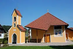 Chapel in Frannach | |
 Frannach Location within Austria | |
| Coordinates: 46°55′00″N 15°38′00″E / 46.91667°N 15.63333°E | |
| Country | Austria |
| State | Styria |
| District | Südoststeiermark |
| Government | |
| • Mayor | Johann Absenger (ÖVP) |
| Area | |
| • Total | 8.04 km2 (3.10 sq mi) |
| Elevation | 316 m (1,037 ft) |
| Population (1 January 2016)[1] | |
| • Total | 558 |
| • Density | 69/km2 (180/sq mi) |
| Time zone | UTC+1 (CET) |
| • Summer (DST) | UTC+2 (CEST) |
| Postal code | 8081 |
| Area code | +43 3116 |
| Vehicle registration | FB |
| Website | www.frannach. steiermark.at |
Frannach is a former municipality in the district of Südoststeiermark in the Austrian state of Styria. Since the 2015 Styria municipal structural reform, it is part of the municipality Pirching am Traubenberg.[2] It is located approximately 23 km (15 miles) to the southeast of Graz.
Population
| Year | Pop. | ±% |
|---|---|---|
| 1869 | 640 | — |
| 1880 | 633 | −1.1% |
| 1890 | 597 | −5.7% |
| 1900 | 574 | −3.9% |
| 1910 | 582 | +1.4% |
| 1923 | 591 | +1.5% |
| 1934 | 623 | +5.4% |
| 1939 | 575 | −7.7% |
| 1951 | 537 | −6.6% |
| 1961 | 499 | −7.1% |
| 1971 | 537 | +7.6% |
| 1981 | 509 | −5.2% |
| 1991 | 516 | +1.4% |
| 2001 | 525 | +1.7% |
| 2013 | 560 | +6.7% |
References
This article is issued from Wikipedia. The text is licensed under Creative Commons - Attribution - Sharealike. Additional terms may apply for the media files.