Furlow, Arkansas | |
|---|---|
 Furlow  Furlow | |
| Coordinates: 34°49′49″N 91°58′50″W / 34.83028°N 91.98056°W | |
| Country | |
| State | |
| County | Lonoke |
| Township | Furlow |
| Elevation | 79 m (259 ft) |
| Time zone | UTC-6 (Central (CST)) |
| • Summer (DST) | UTC-5 (CDT) |
| GNIS feature ID | 57781 |
| U.S. Geological Survey Geographic Names Information System: Furlow, Arkansas | |
Furlow is an unincorporated community in Lonoke County, Arkansas, United States.[1] The community is located west of Lonoke and is surrounded by fish farms.[2]
The community is located at the crossroads of Arkansas Highway 15 south, Arkansas Highway 89 north and east, and Arkansas Highway 294 west.
References
- ↑ "Feature Detail Report for: Furlow, Arkansas." United States Geological Survey. U.S. Geological Survey Geographic Names Information System: Furlow, Arkansas Retrieved February 27, 2011.
- ↑ Arkansas Atlas and Gazetteer (Map) (Second ed.). DeLorme. § 42.
Municipalities and communities of Lonoke County, Arkansas, United States | ||
|---|---|---|
| Cities | 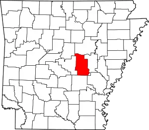 Map of Arkansas highlighting Lonoke County | |
| Towns | ||
| CDP | ||
| Unincorporated communities | ||
| Footnotes | ‡This populated place also has portions in an adjacent county or counties | |
This article is issued from Wikipedia. The text is licensed under Creative Commons - Attribution - Sharealike. Additional terms may apply for the media files.