Güroymak District | |
|---|---|
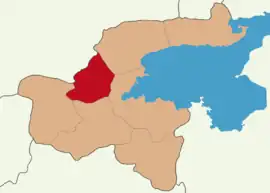 Map showing Güroymak District in Bitlis Province | |
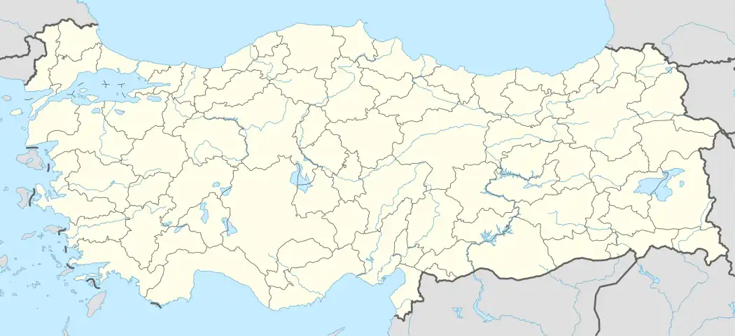 Güroymak District Location in Turkey | |
| Coordinates: 38°35′N 42°1′E / 38.583°N 42.017°E | |
| Country | Turkey |
| Province | Bitlis |
| Seat | Güroymak |
| Government | |
| • Kaymakam | Ramazan Cankaloğlu |
| Area | 515 km2 (199 sq mi) |
| Population (2021) | 48,536 |
| • Density | 94/km2 (240/sq mi) |
| Time zone | TRT (UTC+3) |
| Website | www |
Güroymak District is a district of Bitlis Province of Turkey. Its seat is the town of Güroymak.[1] Its area is 515 km2,[2] and its population is 48,536 (2021).[3]
Tourism
The main places with tourism potential in Güroymak are Güroymak Hot Springs.
Composition
There are three municipalities in Güroymak District:[1][4]
There are 26 villages in Güroymak District:[5]
- Arpacık
- Aşağıkolbaşı
- Budaklı
- Cevizyatağı
- Çallı
- Çayarası
- Çıtak
- Değirmenköy
- Gedikpınar
- Güzelli
- Kaleli
- Kavunlu
- Kekliktepe
- Kuştaşı
- Oduncular
- Özkavak
- Saklı
- Sütderesi
- Tahtalı
- Taşüstü
- Üzümveren
- Yamaçköy
- Yayladere
- Yazıkonak
- Yemişveren
- Yukarıkolbaşı
References
- 1 2 İlçe Belediyesi, Turkey Civil Administration Departments Inventory. Retrieved 30 January 2023.
- ↑ "İl ve İlçe Yüz ölçümleri". General Directorate of Mapping. Retrieved 30 January 2023.
- ↑ "Address-based population registration system (ADNKS) results dated 31 December 2021" (XLS) (in Turkish). TÜİK. Retrieved 30 January 2023.
- ↑ Belde Belediyesi, Turkey Civil Administration Departments Inventory. Retrieved 30 January 2023.
- ↑ Köy, Turkey Civil Administration Departments Inventory. Retrieved 30 January 2023.
Güroymak District in Bitlis Province of Turkey | |||||||||||||||||||||||||||
|---|---|---|---|---|---|---|---|---|---|---|---|---|---|---|---|---|---|---|---|---|---|---|---|---|---|---|---|
| Districts | 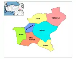 Districts of Bitlis | ||||||||||||||||||||||||||
| |||||||||||||||||||||||||||
Metropolitan municipalities are bolded. | |||||||||||||||||||||||||||
| Municipalities | |
|---|---|
| Villages |
|
This article is issued from Wikipedia. The text is licensed under Creative Commons - Attribution - Sharealike. Additional terms may apply for the media files.