| Gillespie Run Tributary to Youghiogheny River | |
|---|---|
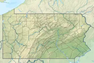 Location of Gillespie Run mouth  Gillespie Run (Youghiogheny River tributary) (the United States) | |
| Location | |
| Country | United States |
| State | Pennsylvania |
| County | Allegheny |
| Physical characteristics | |
| Source | Beckets Run divide |
| • location | about 2 miles west-southwest of Mustard, Pennsylvania[1] |
| • coordinates | 40°13′28″N 079°51′34″W / 40.22444°N 79.85944°W[2] |
| • elevation | 1,115 ft (340 m)[1] |
| Mouth | Youghiogheny River |
• location | Sutersville, Pennsylvania[3] |
• coordinates | 40°14′31″N 079°48′13″W / 40.24194°N 79.80361°W[2] |
• elevation | 738 ft (225 m)[3] |
| Length | 4.11 mi (6.61 km)[4] |
| Basin size | 8.32 square miles (21.5 km2)[5] |
| Discharge | |
| • location | Youghiogheny River |
| • average | 8.25 cu ft/s (0.234 m3/s) at mouth with Youghiogheny River[5] |
| Basin features | |
| Progression | Youghiogheny River → Monongahela River → Ohio River → Mississippi River → Gulf of Mexico |
| River system | Monongahela River |
| Tributaries | |
| • left | Douglass Run |
| • right | unnamed tributaries |
| Bridges | Pond Lane, Guffey Road, PA 51, Scenery Drive, Pineview Drive (x4), Berdar Drive, Douglass Run Road (x2) |
Gillespie Run is a 4.11 mi (6.61 km) long 3rd order tributary to the Youghiogheny River in Allegheny County, Pennsylvania.
Course
Gillespie Run rises about 2 miles west-southwest of Mustard, Pennsylvania,[1] and then flows northeasterly to join the Youghiogheny River across from Sutersville.[3]
Watershed
Gillespie Run drains 8.32 square miles (21.5 km2) of area, receives about 39.5 in/year of precipitation, has a wetness index of 318.16, and is about 62% forested.[5]
References
- 1 2 3 "Get Maps". USGS Topoview. US Geological Survey. Retrieved 20 November 2020.
- 1 2 "GNIS Detail – Gillespie Run". geonames.usgs.gov. US Geological Survey. Retrieved 20 November 2020.
- 1 2 3 "Get Maps". USGS Topoview. US Geological Survey. Retrieved 20 November 2020.
- ↑ "ArcGIS Web Application". epa.maps.arcgis.com. US EPA. Retrieved 19 November 2020.
- 1 2 3 "Gillespie Run Watershed Report". US EPA Geoviewer. US EPA. Retrieved 20 November 2020.
This article is issued from Wikipedia. The text is licensed under Creative Commons - Attribution - Sharealike. Additional terms may apply for the media files.