| Gorakhgad Fort | |
|---|---|
| Part of Sahyadri Hill Range | |
| Thane district, Maharashtra | |
 Gorakhgad fort | |
 Gorakhgad Fort | |
| Coordinates | 19°11′31.9″N 73°32′26.8″E / 19.192194°N 73.540778°E |
| Type | Hill fort |
| Height | 649.22 M(2130 Ft) |
| Site information | |
| Owner | Government of India |
| Open to the public | Yes |
| Condition | Ruins |
| Site history | |
| In use | Hermits for meditation |
| Materials | Stone |
Gorakhgad Fort is a fort located 24 km from Murbad, Thane district, of Maharashtra. This fort is an important fort in Thane district. This fort was mainly used by sadhus or hermits for meditation.and also by local people's of surrounding village,[1] It was also used to guard the ancient trade route passing through Naneghat.
Location
The nearest town is Dehri Talekhal village which is 24 km from murbad.
Description
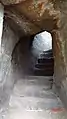
After main entrance gate there is an inscription in Marathi. There are rock cut water cisterns near the cave. The water is available round the year for drinking purpose. The cave is spacious and has square pillars.[2] There is a small Mahadev temple on the top. The Ahupe Ghat and Siddhagad can be seen from the top.[3]
Gallery
 Main gate of Gorakhgad Fort
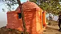 Gorakshnath temple on the top
 Cave on the fort
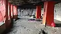 Inside the Cave in the fort
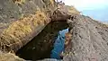 Rock-cut water cistern
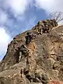 Way to the balekilla
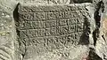 Inscription in Prakrut Marathi
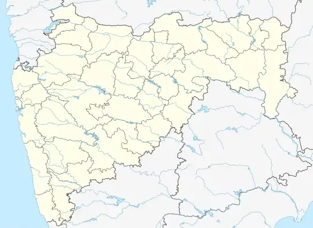
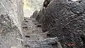 Steps to balekilla
See also
References
- ↑ "Gorakhgad, Sahyadri,Shivaji,Trekking,Marathi,Maharastra". Archived from the original on 31 May 2017. Retrieved 15 July 2017.
- ↑ "Gazetteers Of The Bombay Presidency - Thana". Gazetteers.maharashtra.gov.in. Retrieved 12 August 2022.
- ↑ Book "Saad Sahydrichi-Bhatkanti killyanchi" by P.K. Ghanekar
This article is issued from Wikipedia. The text is licensed under Creative Commons - Attribution - Sharealike. Additional terms may apply for the media files.