Goulet | |
|---|---|
Part of Monts-sur-Orne | |
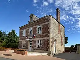 The town hall of Goulet | |
Location of Goulet | |
 Goulet  Goulet | |
| Coordinates: 48°44′01″N 0°05′30″W / 48.7336°N 0.0917°W | |
| Country | France |
| Region | Normandy |
| Department | Orne |
| Arrondissement | Argentan |
| Canton | Magny-le-Désert |
| Commune | Monts-sur-Orne |
| Area 1 | 9.3 km2 (3.6 sq mi) |
| Population (2019)[1] | 385 |
| • Density | 41/km2 (110/sq mi) |
| Time zone | UTC+01:00 (CET) |
| • Summer (DST) | UTC+02:00 (CEST) |
| Postal code | 61150 |
| Elevation | 147–194 m (482–636 ft) (avg. 158 m or 518 ft) |
| 1 French Land Register data, which excludes lakes, ponds, glaciers > 1 km2 (0.386 sq mi or 247 acres) and river estuaries. | |
Goulet (French pronunciation: [gulɛ] ⓘ) is a former commune in the Orne department in north-western of France.[2] On 1 January 2018, it was merged into the new commune of Monts-sur-Orne.[3]
Demographics
| Year | 1962 | 1968 | 1975 | 1982 | 1990 | 1999 | 2012 |
|---|---|---|---|---|---|---|---|
| Population | 288 | 290 | 305 | 293 | 307 | 304 | 398 |
| From the year 1962 on: No double counting—residents of multiple communes (e.g. students and military personnel) are counted only once. | |||||||
See also
References
- ↑ Téléchargement du fichier d'ensemble des populations légales en 2019, INSEE
- ↑ Des villages de Cassini aux communes d'aujourd'hui: Commune data sheet Goulet, EHESS (in French).
- ↑ Arrêté préfectoral 18 December 2017 (in French)
Wikimedia Commons has media related to Goulet (Orne).
This article is issued from Wikipedia. The text is licensed under Creative Commons - Attribution - Sharealike. Additional terms may apply for the media files.