Goupillières | |
|---|---|
Part of Montillières-sur-Orne | |
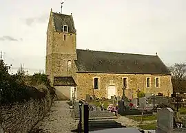 The church in Goupillières | |
Location of Goupillières | |
 Goupillières  Goupillières | |
| Coordinates: 49°01′58″N 0°28′42″W / 49.0328°N 0.4783°W | |
| Country | France |
| Region | Normandy |
| Department | Calvados |
| Arrondissement | Caen |
| Canton | Le Hom |
| Commune | Montillières-sur-Orne |
| Area 1 | 2.27 km2 (0.88 sq mi) |
| Population (2016)[1] | 178 |
| • Density | 78/km2 (200/sq mi) |
| Time zone | UTC+01:00 (CET) |
| • Summer (DST) | UTC+02:00 (CEST) |
| Postal code | 14210 |
| Elevation | 14–165 m (46–541 ft) (avg. 117 m or 384 ft) |
| 1 French Land Register data, which excludes lakes, ponds, glaciers > 1 km2 (0.386 sq mi or 247 acres) and river estuaries. | |
Goupillières (French pronunciation: [ɡupijɛʁ] ⓘ) is a former commune in the Calvados department in the Normandy region in northwestern France. On 1 January 2019, it was merged into the new commune Montillières-sur-Orne.[2]
The former commune is part of the area known as Suisse Normande.[3]
Population
| Year | Pop. | ±% |
|---|---|---|
| 1962 | 91 | — |
| 1968 | 78 | −14.3% |
| 1975 | 89 | +14.1% |
| 1982 | 117 | +31.5% |
| 1990 | 115 | −1.7% |
| 1999 | 150 | +30.4% |
| 2008 | 158 | +5.3% |
See also
References
- ↑ Téléchargement du fichier d'ensemble des populations légales en 2016, INSEE
- ↑ Arrêté préfectoral 28 September 2018, p. 91 (in French)
- ↑ "Map of Suiss Normande" (PDF).
Wikimedia Commons has media related to Goupillières (Calvados).
This article is issued from Wikipedia. The text is licensed under Creative Commons - Attribution - Sharealike. Additional terms may apply for the media files.