Sankt Bernhard-Frauenhofen | |
|---|---|
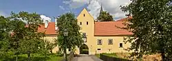 The former abbey | |
 Coat of arms | |
 Sankt Bernhard-Frauenhofen Location within Austria | |
| Coordinates: 48°41′N 15°36′E / 48.683°N 15.600°E | |
| Country | Austria |
| State | Lower Austria |
| District | Horn |
| Government | |
| • Mayor | Karl Gabler |
| Area | |
| • Total | 29.48 km2 (11.38 sq mi) |
| Elevation | 328 m (1,076 ft) |
| Population (2018-01-01)[2] | |
| • Total | 1,299 |
| • Density | 44/km2 (110/sq mi) |
| Time zone | UTC+1 (CET) |
| • Summer (DST) | UTC+2 (CEST) |
| Postal code | 3580 |
| Area code | 02982 |
Sankt Bernhard-Frauenhofen is a town in the district of Horn in Lower Austria in Austria. 21.03% of the municipality are forested. It lies in the Waldviertel area, in the valley of the river Taffa. There are 95 agricultural companies and 67 non-agricultural jobs. 597 persons are employed. The activity rate was 48.17%.
Subdivisions
Sankt Bernhard-Frauenhofen is subdivided into the following Katastralgemeinden:
- Frauenhofen
- Groß Burgstall
- Grünberg
- Poigen
- St. Bernhard
- Strögen
Population
| Year | Pop. | ±% |
|---|---|---|
| 1971 | 1,143 | — |
| 1981 | 1,168 | +2.2% |
| 1991 | 1,197 | +2.5% |
| 2001 | 1,289 | +7.7% |
References
- ↑ "Dauersiedlungsraum der Gemeinden Politischen Bezirke und Bundesländer - Gebietsstand 1.1.2018". Statistics Austria. Retrieved 10 March 2019.
- ↑ "Einwohnerzahl 1.1.2018 nach Gemeinden mit Status, Gebietsstand 1.1.2018". Statistics Austria. Retrieved 9 March 2019.
This article is issued from Wikipedia. The text is licensed under Creative Commons - Attribution - Sharealike. Additional terms may apply for the media files.