Sigmundsherberg | |
|---|---|
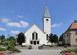 Church of Saint Christopher | |
 Coat of arms | |
 Sigmundsherberg Location within Austria | |
| Coordinates: 48°41′10″N 15°44′47″E / 48.68611°N 15.74639°E | |
| Country | Austria |
| State | Lower Austria |
| District | Horn |
| Government | |
| • Mayor | Franz Göd (ÖVP) |
| Area | |
| • Total | 47.95 km2 (18.51 sq mi) |
| Elevation | 429 m (1,407 ft) |
| Population (2018-01-01)[2] | |
| • Total | 1,651 |
| • Density | 34/km2 (89/sq mi) |
| Time zone | UTC+1 (CET) |
| • Summer (DST) | UTC+2 (CEST) |
| Postal code | 3751 |
| Area code | 02983 |
| Vehicle registration | HO |
| Website | www.sigmundsherberg.gv.at |
Sigmundsherberg is a municipality in the district of Horn in Lower Austria, Austria.
Population
| Year | Pop. | ±% |
|---|---|---|
| 1869 | 1,860 | — |
| 1880 | 1,985 | +6.7% |
| 1890 | 2,085 | +5.0% |
| 1900 | 2,362 | +13.3% |
| 1910 | 2,489 | +5.4% |
| 1923 | 2,861 | +14.9% |
| 1934 | 2,738 | −4.3% |
| 1939 | 2,593 | −5.3% |
| 1951 | 2,506 | −3.4% |
| 1961 | 2,426 | −3.2% |
| 1971 | 2,035 | −16.1% |
| 1981 | 1,887 | −7.3% |
| 1991 | 1,887 | +0.0% |
| 2001 | 1,802 | −4.5% |
| 2011 | 1,667 | −7.5% |
References
- ↑ "Dauersiedlungsraum der Gemeinden Politischen Bezirke und Bundesländer - Gebietsstand 1.1.2018". Statistics Austria. Retrieved 10 March 2019.
- ↑ "Einwohnerzahl 1.1.2018 nach Gemeinden mit Status, Gebietsstand 1.1.2018". Statistics Austria. Retrieved 9 March 2019.
External links
Wikimedia Commons has media related to Sigmundsherberg.
This article is issued from Wikipedia. The text is licensed under Creative Commons - Attribution - Sharealike. Additional terms may apply for the media files.