Hardens | |
 Property entrance | |
  | |
| Location | West of Lamptie Hill on State Route 5 |
|---|---|
| Coordinates | 37°22′16″N 77°14′12″W / 37.37111°N 77.23667°W |
| Area | 554 acres (224 ha) |
| Built | c. 1845-1846, 1849 |
| NRHP reference No. | 83003266[1] |
| VLR No. | 018-0045 |
| Significant dates | |
| Added to NRHP | February 10, 1983 |
| Designated VLR | December 15, 1981[2] |
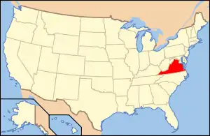
Hardens is a historic home and farm located near Lamptie Hill, Charles City County, Virginia. The main house is a 1+1⁄2-story, single-pile house, a typical example of mid-19th century Virginia vernacular architecture. The original section was built about 1845–1846, and expanded about 1849. It has a gable roof with dormers and features a one-story porch with turned posts and a flat roof. Contributing buildings and structures include a former kitchen, two-story tenant house, and a variety of barns and sheds. During the American Civil War Hardens was used as a Union communications station and was later a camp for General Philip Sheridan.[3]
It was added to the National Register of Historic Places in 1983.[1]
References
- 1 2 "National Register Information System". National Register of Historic Places. National Park Service. July 9, 2010.
- ↑ "Virginia Landmarks Register". Virginia Department of Historic Resources. Retrieved 5 June 2013.
- ↑ Virginia Historic Landmarks Commission Staff (December 1981). "National Register of Historic Places Inventory/Nomination: Hardens" (PDF). and Accompanying photo
This article is issued from Wikipedia. The text is licensed under Creative Commons - Attribution - Sharealike. Additional terms may apply for the media files.

