| Headwall Lake | |
|---|---|
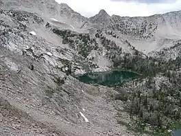 | |
 Headwall Lake  Headwall Lake | |
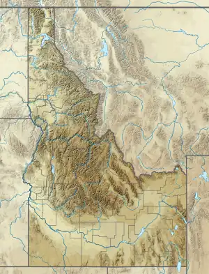
| Location | Custer County, Idaho |
| Coordinates | 44°04′28″N 114°35′54″W / 44.074340°N 114.598370°W |
| Type | Glacial |
| Primary inflows | Snow melt |
| Primary outflows | Little Boulder Creek to East Fork Salmon River |
| Basin countries | United States |
| Max. length | 840 ft (260 m) |
| Max. width | 531 ft (162 m) |
| Surface area | 7.0 acres (2.8 ha) |
| Surface elevation | 9,760 ft (2,970 m)[1] |
Headwall Lake is an alpine lake in Custer County, Idaho, United States, located in the White Cloud Mountains in the Sawtooth National Recreation Area.[1] The lake is accessed from Sawtooth National Forest trail 683.[2]
Headwall Lake is northwest of Merriam Peak and located in the lower section of the Boulder Chain Lakes Basin.
See also
References
- 1 2 U.S. Geological Survey Geographic Names Information System: Headwall Lake
- ↑ Sawtooth National Forest. "Sawtooth National Forest" [map].1:126,720, 1"=2 miles. Twin Falls, Idaho: Sawtooth National Forest, United States Forest Service, 1998.
This article is issued from Wikipedia. The text is licensed under Creative Commons - Attribution - Sharealike. Additional terms may apply for the media files.