Hengzhou
横州市 · Hwngzcouh Si | |
|---|---|
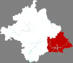 Location in Nanning | |
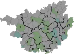 Hengzhou Location of the seat in Guangxi | |
| Coordinates: 22°40′48″N 109°15′41″E / 22.6799°N 109.2614°E[1] | |
| Country | People's Republic of China |
| Autonomous region | Guangxi |
| Prefecture-level city | Nanning |
| Subdivisions | 14 towns 3 townships |
| Seat | Hengzhou (横州镇) |
| Area | |
| • Total | 3,464 km2 (1,337 sq mi) |
| Elevation | 56 m (185 ft) |
| Population (2010)[3] | |
| • Total | 863,001 |
| • Density | 250/km2 (650/sq mi) |
| Time zone | UTC+8 (China Standard) |
| Postal code | 5303XX |
Hengzhou (Chinese: 横州; pinyin: Héngzhōu Shì), formerly, Heng County or Hengxian (simplified Chinese: 横县; traditional Chinese: 橫縣; pinyin: Héng Xiàn; Standard Zhuang: Hwngz Yen) is a county-level city of Guangxi Zhuang Autonomous Region, China; it is under the administration of the prefecture-level city of Nanning, the capital of Guangxi, with a permanent population of 863,001 and a hukou population of 1,200,521[4] as of the 2010 Census. The easternmost county-level division of Nanning City, it borders the prefecture-level cities of Guigang to the northeast, Yulin to the east, and Qinzhou to the south. 60% speak Pinghua as their mother tongue and a further 30% speak Pingua as a second language.[5] The county-level city was approved and elevated by the former Heng County by the State Council on February 3, 2021.
Administrative divisions
There are 14 towns and 3 townships in the county-level city:[6]
Towns:
- Hengzhou (横州镇), Luancheng (峦城镇), Liujing (六景镇), Shitang (石塘镇), Taoxu (陶圩镇), Xiaoyi (校椅镇), Yunbiao (云表镇), Baihe (百合镇), Nayang (那阳镇), Nanxiang (南乡镇), Xinfu (新福镇), Liantang (莲塘镇), Pingma (平马镇), Maling (马岭镇)
Townships:
- Mashan Township (马山乡), Pinglang Township (平朗乡), Zhenlong Township (镇龙乡)
Climate
| Climate data for Hengzhou (1991–2020 normals, extremes 1981–2010) | |||||||||||||
|---|---|---|---|---|---|---|---|---|---|---|---|---|---|
| Month | Jan | Feb | Mar | Apr | May | Jun | Jul | Aug | Sep | Oct | Nov | Dec | Year |
| Record high °C (°F) | 28.5 (83.3) |
32.9 (91.2) |
33.1 (91.6) |
34.8 (94.6) |
35.8 (96.4) |
37.5 (99.5) |
38.5 (101.3) |
38.0 (100.4) |
37.9 (100.2) |
35.2 (95.4) |
32.8 (91.0) |
30.8 (87.4) |
38.5 (101.3) |
| Mean daily maximum °C (°F) | 16.5 (61.7) |
18.5 (65.3) |
21.1 (70.0) |
26.6 (79.9) |
30.4 (86.7) |
32.0 (89.6) |
32.8 (91.0) |
32.8 (91.0) |
31.5 (88.7) |
28.5 (83.3) |
24.2 (75.6) |
19.0 (66.2) |
26.2 (79.1) |
| Daily mean °C (°F) | 12.4 (54.3) |
14.5 (58.1) |
17.3 (63.1) |
22.5 (72.5) |
26.1 (79.0) |
27.8 (82.0) |
28.3 (82.9) |
28.1 (82.6) |
26.7 (80.1) |
23.5 (74.3) |
19.1 (66.4) |
14.2 (57.6) |
21.7 (71.1) |
| Mean daily minimum °C (°F) | 9.6 (49.3) |
11.7 (53.1) |
14.7 (58.5) |
19.6 (67.3) |
22.9 (73.2) |
24.9 (76.8) |
25.3 (77.5) |
25.0 (77.0) |
23.4 (74.1) |
19.8 (67.6) |
15.5 (59.9) |
10.9 (51.6) |
18.6 (65.5) |
| Record low °C (°F) | 0.8 (33.4) |
0.9 (33.6) |
2.7 (36.9) |
7.5 (45.5) |
13.9 (57.0) |
18.1 (64.6) |
20.1 (68.2) |
20.5 (68.9) |
15.1 (59.2) |
9.4 (48.9) |
5.1 (41.2) |
−0.5 (31.1) |
−0.5 (31.1) |
| Average precipitation mm (inches) | 53.2 (2.09) |
45.2 (1.78) |
86.6 (3.41) |
98.0 (3.86) |
192.1 (7.56) |
259.7 (10.22) |
273.9 (10.78) |
220.5 (8.68) |
139.5 (5.49) |
72.3 (2.85) |
62.3 (2.45) |
41.3 (1.63) |
1,544.6 (60.8) |
| Average precipitation days (≥ 0.1 mm) | 10.3 | 11.0 | 15.8 | 13.5 | 15.4 | 17.6 | 17.7 | 16.6 | 11.3 | 6.4 | 7.0 | 7.4 | 150 |
| Average relative humidity (%) | 77 | 79 | 83 | 81 | 80 | 83 | 82 | 83 | 80 | 75 | 74 | 72 | 79 |
| Mean monthly sunshine hours | 68.4 | 55.4 | 47.8 | 83.2 | 137.0 | 134.1 | 178.2 | 180.8 | 174.5 | 172.2 | 137.3 | 113.8 | 1,482.7 |
| Percent possible sunshine | 20 | 17 | 13 | 22 | 33 | 33 | 43 | 46 | 48 | 48 | 42 | 34 | 33 |
| Source: China Meteorological Administration[7][8] | |||||||||||||
References
- ↑ Google (2014-07-02). "Hengxian" (Map). Google Maps. Google. Retrieved 2014-07-02.
- ↑ Nanning City Land Use Plan (2006–20)/《南宁市土地利用总体规划(2006-2020年)》.(in Chinese) Accessed 8 July 2014.
- ↑ 《中国2010年人口普查分县资料》 (in Chinese). China Statistics Print. December 2012. ISBN 978-7-5037-6659-6.
- ↑ 《中华人民共和国全国分县市人口统计资料2010》. 群众出版社. November 2011. ISBN 978-7-5014-4917-0.
- ↑ Yu Jin (余谨), ed. (2016). 广西平话研究. p. 88f. ISBN 978-7-5161-8896-5.
- ↑ 2011年统计用区划代码和城乡划分代码:横县 (in Simplified Chinese). National Bureau of Statistics of the People's Republic of China. Archived from the original on 2012-07-21. Retrieved 2013-01-03.
- ↑ 中国气象数据网 – WeatherBk Data (in Simplified Chinese). China Meteorological Administration. Retrieved 28 May 2023.
- ↑ 中国气象数据网 (in Simplified Chinese). China Meteorological Administration. Retrieved 28 May 2023.
External links