Rong County
容县 Jung County | |
|---|---|
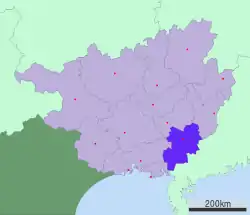
.png.webp) Rong County is the northeasternmost division on this map of Yulin | |
 Yulin in Guangxi | |
| Coordinates: 22°51′32″N 110°33′29″E / 22.859°N 110.558°E | |
| Country | People's Republic of China |
| Autonomous region | Guangxi |
| Prefecture-level city | Yulin |
| Area | |
| • Total | 2,257.39 km2 (871.58 sq mi) |
| Time zone | UTC+8 (China Standard) |
| Rongxian | |||||||||
|---|---|---|---|---|---|---|---|---|---|
| Traditional Chinese | 容縣 | ||||||||
| Simplified Chinese | 容县 | ||||||||
| Postal | Junghsien | ||||||||
| |||||||||
Rongxian (Chinese: 容县; also called Rong Xian or Rong County) is a county in the southeast of Guangxi, China, bordering Guangdong province to the southeast. It occupies the northeast corner of the prefecture-level city of Yulin. Its population is approximately 700,000.[1]
Duqiao Mountain (都峤山), located in Rongxian, is a famous Taoist sanctuary.[2] Other tourist sites include the Zhenwu Pavilion (真武阁).
Transport
Climate
| Climate data for Rongxian (1991–2020 normals, extremes 1981–2010) | |||||||||||||
|---|---|---|---|---|---|---|---|---|---|---|---|---|---|
| Month | Jan | Feb | Mar | Apr | May | Jun | Jul | Aug | Sep | Oct | Nov | Dec | Year |
| Record high °C (°F) | 29.2 (84.6) |
32.5 (90.5) |
34.1 (93.4) |
35.2 (95.4) |
35.1 (95.2) |
37.1 (98.8) |
38.3 (100.9) |
37.9 (100.2) |
37.7 (99.9) |
35.0 (95.0) |
33.0 (91.4) |
30.1 (86.2) |
38.3 (100.9) |
| Mean daily maximum °C (°F) | 17.3 (63.1) |
19.1 (66.4) |
21.7 (71.1) |
26.5 (79.7) |
30.2 (86.4) |
31.9 (89.4) |
32.9 (91.2) |
32.9 (91.2) |
31.5 (88.7) |
28.7 (83.7) |
24.6 (76.3) |
19.4 (66.9) |
26.4 (79.5) |
| Daily mean °C (°F) | 12.8 (55.0) |
14.8 (58.6) |
17.7 (63.9) |
22.4 (72.3) |
25.7 (78.3) |
27.3 (81.1) |
28.0 (82.4) |
27.8 (82.0) |
26.5 (79.7) |
23.6 (74.5) |
19.2 (66.6) |
14.5 (58.1) |
21.7 (71.0) |
| Mean daily minimum °C (°F) | 9.8 (49.6) |
11.9 (53.4) |
15.0 (59.0) |
19.5 (67.1) |
22.7 (72.9) |
24.5 (76.1) |
24.9 (76.8) |
24.7 (76.5) |
23.2 (73.8) |
19.9 (67.8) |
15.6 (60.1) |
11.0 (51.8) |
18.6 (65.4) |
| Record low °C (°F) | 0.9 (33.6) |
1.2 (34.2) |
2.8 (37.0) |
8.0 (46.4) |
12.7 (54.9) |
17.7 (63.9) |
19.9 (67.8) |
20.9 (69.6) |
15.0 (59.0) |
9.7 (49.5) |
4.1 (39.4) |
0.0 (32.0) |
0.0 (32.0) |
| Average precipitation mm (inches) | 64.5 (2.54) |
49.6 (1.95) |
90.4 (3.56) |
159.6 (6.28) |
276.4 (10.88) |
283.8 (11.17) |
218.7 (8.61) |
223.0 (8.78) |
135.5 (5.33) |
64.5 (2.54) |
57.1 (2.25) |
43.3 (1.70) |
1,666.4 (65.59) |
| Average precipitation days (≥ 0.1 mm) | 10.7 | 11.3 | 16.0 | 15.6 | 18.9 | 20.8 | 18.7 | 17.6 | 12.2 | 5.7 | 7.0 | 7.3 | 161.8 |
| Average relative humidity (%) | 76 | 79 | 83 | 82 | 82 | 83 | 81 | 82 | 79 | 73 | 72 | 71 | 79 |
| Mean monthly sunshine hours | 92.6 | 76.3 | 60.4 | 92.2 | 140.4 | 148.4 | 196.8 | 198.6 | 190.1 | 198.7 | 163.3 | 137.2 | 1,695 |
| Percent possible sunshine | 27 | 24 | 16 | 24 | 34 | 37 | 48 | 50 | 52 | 56 | 50 | 41 | 38 |
| Source: China Meteorological Administration[3][4] | |||||||||||||
See also
- Yangmei, Rong County
- Ramadan ibn Alauddin, a Muslim from Korea who governed Rong County in the 1340s
References
- ↑ http://www.chinatoday.com.cn/English/e2002/e20029/rongxian.htm
- ↑ http://www.chinatoday.com.cn/English/e2002/e20029/rongxian.htm
- ↑ 中国气象数据网 – WeatherBk Data (in Simplified Chinese). China Meteorological Administration. Retrieved 28 May 2023.
- ↑ "Experience Template" 中国气象数据网 (in Simplified Chinese). China Meteorological Administration. Retrieved 28 May 2023.
External links
This article is issued from Wikipedia. The text is licensed under Creative Commons - Attribution - Sharealike. Additional terms may apply for the media files.