Hensley Township | |
|---|---|
 | |
| Coordinates: 39°23′29″N 86°11′28″W / 39.39139°N 86.19111°W | |
| Country | United States |
| State | Indiana |
| County | Johnson |
| Government | |
| • Type | Indiana township |
| Area | |
| • Total | 36.92 sq mi (95.6 km2) |
| • Land | 36.49 sq mi (94.5 km2) |
| • Water | 0.43 sq mi (1.1 km2) |
| Elevation | 735 ft (224 m) |
| Population (2010) | |
| • Total | 3,329 |
| • Density | 91.2/sq mi (35.2/km2) |
| FIPS code | 18-33160[2] |
| GNIS feature ID | 453408 |
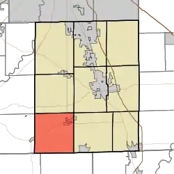
Hensley Township is one of nine townships in Johnson County, Indiana. As of the 2010 census, its population was 3,329 and it contained 1,341 housing units.[3] Most of Trafalgar is in the northeast corner of the township.
Hensley Township was organized in 1827.[4]
Geography
According to the 2010 census, the township has a total area of 36.92 square miles (95.6 km2), of which 36.49 square miles (94.5 km2) (or 98.84%) is land and 0.43 square miles (1.1 km2) (or 1.16%) is water.[3]
References
- ↑ "US Board on Geographic Names". United States Geological Survey. October 25, 2007. Retrieved January 31, 2008.
- ↑ "U.S. Census website". United States Census Bureau. Retrieved January 31, 2008.
- 1 2 "Population, Housing Units, Area, and Density: 2010 - County -- County Subdivision and Place -- 2010 Census Summary File 1". United States Census. Archived from the original on February 12, 2020. Retrieved May 10, 2013.
- ↑ Banta, David Demaree (1881). A Historical Sketch of Johnson County, Indiana. J.H. Beers & Company. pp. 73.
External links
Municipalities and communities of Johnson County, Indiana, United States | ||
|---|---|---|
| Cities | Map of Indiana highlighting Johnson County | |
| Towns | ||
| Townships | ||
| CDPs | ||
| Other communities | ||
| Footnotes | ‡This populated place also has portions in an adjacent county or counties | |
This article is issued from Wikipedia. The text is licensed under Creative Commons - Attribution - Sharealike. Additional terms may apply for the media files.