| Hevenor Inlet | |
|---|---|
| K’t’a’i (Tsimshian)[1] | |
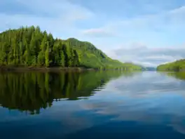 Looking westward down Hevenor Inlet | |
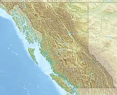  Hevenor Inlet | |
| Location | British Columbia |
| Coordinates | 53°38′28″N 129°59′17″W / 53.64111°N 129.98806°W |
| Type | Fjord |
| Part of | Pitt Island (Canada) |
| Max. length | 3.4 nautical miles (6.3 km; 3.9 mi) |
| Max. width | 0.6 nautical miles (1.1 km; 0.69 mi) |
| Islands | Clark Islet, Hevenor Islet |
Hevenor Inlet extends eastward from Petrel Channel on the northwest side of Pitt Island, British Columbia, Canada.[2]
The inlet is entered between Stark Point[3] and Hevenor Point,[4] and contains Clark[5] and Hevenor[6] islets. A narrow entrance connects the inlet to Hevenor Lagoon[7] 4 nautical miles (7.4 km; 4.6 mi) southeast of the head of the inlet.[8]
Two Indian Reserves adjoin the inlet, Pitt Island 27[9] on the north shore near the entrance, and Ketai 28[10] midway down the south shore.
Hevenor Inlet is surrounded by waterfalls, including the Cascades, a linear series of waterfalls at the head of the inlet.
Image Gallery

Wikimedia Commons has media related to Hevenor Inlet.
 The mouth of the Cascades at the head of Hevenor Inlet
 Fog lifting around Clark Islet
 The narrows between the Inlet and the Lagoon
 Looking at Hevenor Islet from the southwest
 Stark Point, south of the mouth of Hevenor Inlet
 Hevenor Point, north of the mouth of Hevenor Inlet
References
- ↑ Susan Marsden (2011). The Gitkxaala, Their History, and Their Territories (Porcher Island, Banks Island, Pitt Island and Adjacent Islands) (PDF) (Report). p. 55.
- ↑ "Hevenor Inlet". BC Geographical Names.
- ↑ "Stark Point". BC Geographical Names.
- ↑ "Hevenor Point". BC Geographical Names.
- ↑ "Clark Islet". BC Geographical Names.
- ↑ "Hevenor Inlet". BC Geographical Names.
- ↑ "Hevenor Lagoon". BC Geographical Names.
- ↑ "Chart 3746, Petrel Channel". Sailing Directions, British Columbia Coast, (Northern Portion). II (Ninth Edition): 259. 1983.
- ↑ "Pitt Island 27". BC Geographical Names.
- ↑ "Ketai 28". BC Geographical Names.
This article is issued from Wikipedia. The text is licensed under Creative Commons - Attribution - Sharealike. Additional terms may apply for the media files.