Hitrino Municipality
Община Хитрино | |
|---|---|
Municipality | |
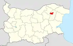 Hitrino Municipality within Bulgaria and Shumen Province. | |
| Coordinates: 43°26′N 26°53′E / 43.433°N 26.883°E | |
| Country | |
| Province (Oblast) | Shumen |
| Admin. centre (Obshtinski tsentar) | Hitrino |
| Area | |
| • Total | 289.37 km2 (111.73 sq mi) |
| Population (December 2009)[1] | |
| • Total | 6,423 |
| • Density | 22/km2 (57/sq mi) |
| Time zone | UTC+2 (EET) |
| • Summer (DST) | UTC+3 (EEST) |
Hitrino Municipality (Bulgarian: Община Хитрино) is a municipality (obshtina) in Shumen Province, Northeastern Bulgaria, located in the Ludogorie geographical region, part of the Danubian Plain. It is named after its administrative centre - the village of Hitrino.
The municipality embraces a territory of 288 km2 (111 sq mi) with a population of 6,423 inhabitants, as of December 2009.[1]
Settlements
.png.webp)
Hitrino Municipality within Shumen Province
Kaspichan
Novi Pazar
Veliki Preslav
Smyadovo
Varbitsa
Kaolinovo
Venets
Nikola Kozlevo
Hitrino Municipality includes the following 23 places, all of them are villages:
| Town/Village | Cyrillic | Population[2][3][4] (December 2009) |
|---|---|---|
| Hitrino | Хитрино | 715 |
| Baykovo | Байково | 148 |
| Bliznatsi | Близнаци | 221 |
| Cherna | Черна | 318 |
| Dlazhko | Длъжко | 161 |
| Dobri Voynikovo | Добри Войниково | 160 |
| Edinakovtsi | Единаковци | 124 |
| Iglika | Иглика | 205 |
| Kalino | Калино | 180 |
| Kamenyak | Каменяк | 537 |
| Razvigorovo | Развигорово | 251 |
| Slivak | Сливак | 185 |
| Stanovets | Становец | 46 |
| Studenitsa | Студеница | 454 |
| Tervel | Тервел | 285 |
| Timarevo | Тимарево | 791 |
| Trem | Трем | 280 |
| Visoka Polyana | Висока поляна | 211 |
| Varbak | Върбак | 344 |
| Zhivkovo | Живково | 567 |
| Zvegor | Звегор | 240 |
| Total | 6,423 |
Demography
The following table shows the change of the population during the last four decades.
| Hitrino Municipality | ||||||||
|---|---|---|---|---|---|---|---|---|
| Year | 1975 | 1985 | 1992 | 2001 | 2005 | 2007 | 2009 | 2011 |
| Population | 15,726 | 13,062 | 8,624 | 7,045 | 6,937 | 6,664 | 6,423 | 6,223 |
| Sources: Census 2001,[5] Census 2011,[6] „pop-stat.mashke.org“,[7] | ||||||||
Ethnic composition
According to the 2011 census, among those who answered the optional question on ethnic identification, the ethnic composition of the municipality was the following:
| Ethnic group | Population | Percentage |
|---|---|---|
| Bulgarians | 867 | 15% |
| Turks | 4853 | 84% |
| Roma (Gypsy) | 26 | 0.4% |
| Other | 10 | 0.2% |
| Undeclared | 24 | 0.4% |
Religious composition
See also
References
- 1 2 (in English) Bulgarian National Statistical Institute - Bulgarian provinces and municipalities in 2009
- ↑ (in English) Bulgarian National Statistical Institute - Bulgarian towns in 2009
- ↑ (in English) Bulgarian National Statistical Institute - Bulgarian villages under 1000 inhabitants - December 2009
- ↑ (in English) Bulgarian National Statistical Institute - Bulgarian Settlements 1000-5000 inhabitants - December 2009
- ↑ National Statistical Institute - Census 2001
- ↑ Population by province, municipality, settlement and age by 01.02.2011; Bulgarian National Statistical Institute Archived 2013-09-08 at the Wayback Machine
- ↑ Population of Bulgarian divisions
- ↑ Population by province, municipality, settlement and ethnic identification, by 01.02.2011; Bulgarian National Statistical Institute Archived 2013-05-21 at the Wayback Machine (in Bulgarian)
External links
- Official website (in Bulgarian)
This article is issued from Wikipedia. The text is licensed under Creative Commons - Attribution - Sharealike. Additional terms may apply for the media files.