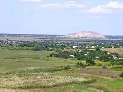
Horbachevo-Mykhaylivka
Горбачево-Михайлівка | |
|---|---|
 | |
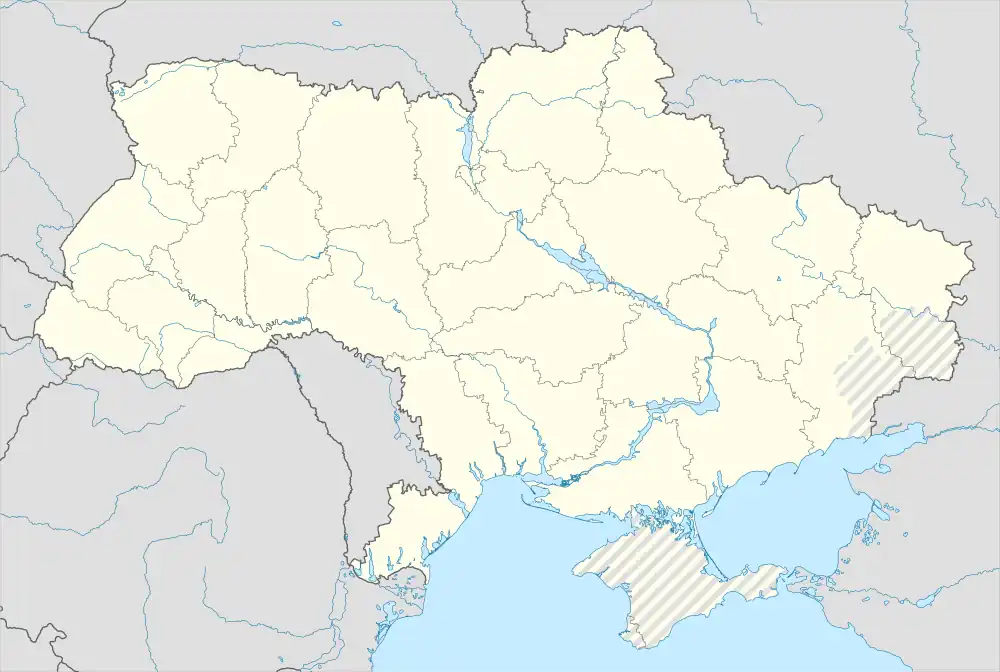 Horbachevo-Mykhaylivka Location of Horbachevo-Mykhaylivka in Donetsk Oblast 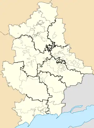 Horbachevo-Mykhaylivka Horbachevo-Mykhaylivka (Donetsk Oblast) | |
| Coordinates: 47°51′02″N 38°00′42″E / 47.85056°N 38.01167°E | |
| Country | |
| Oblast | |
| Raion | Donetsk Raion |
| Municipality (de jure) | Donetsk |
| Urban district | Proletarskyi District |
| Area | |
| • Total | 0.77 km2 (0.30 sq mi) |
| Elevation | 100 m (300 ft) |
| Population (2022)[2] | |
| • Total | 917 |
| • Density | 1,200/km2 (3,100/sq mi) |
| Time zone | UTC+2 |
| • Summer (DST) | UTC+3 |
| Postal code | 83499 |
| Area code | +380 62 |
Horbachevo-Mykhaylivka (Ukrainian: Горбачево-Михайлівка) is an urban-type settlement in Proletarskyi District of Donetsk municipality, Donetsk Oblast, eastern Ukraine. Since 2014, it has been under the control of the self-declared Donetsk People's Republic. Population: 917 (2022 estimate).[2]
References
- ↑ "Novoselivka (Donetsk Oblast)". weather.in.ua. Retrieved 17 June 2022.
- 1 2 Чисельність наявного населення України на 1 січня 2022 [Number of Present Population of Ukraine, as of January 1, 2022] (PDF) (in Ukrainian and English). Kyiv: State Statistics Service of Ukraine. Archived (PDF) from the original on 4 July 2022.
This article is issued from Wikipedia. The text is licensed under Creative Commons - Attribution - Sharealike. Additional terms may apply for the media files.