Houtteville | |
|---|---|
Part of Picauville | |
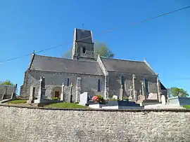 The church of Saint-Jean-Baptiste | |
Location of Houtteville | |
 Houtteville  Houtteville | |
| Coordinates: 49°20′21″N 1°21′39″W / 49.3392°N 1.3608°W | |
| Country | France |
| Region | Normandy |
| Department | Manche |
| Arrondissement | Cherbourg |
| Canton | Carentan |
| Commune | Picauville |
| Area 1 | 4.51 km2 (1.74 sq mi) |
| Population (2019)[1] | 70 |
| • Density | 16/km2 (40/sq mi) |
| Demonym | Houttevillais |
| Time zone | UTC+01:00 (CET) |
| • Summer (DST) | UTC+02:00 (CEST) |
| Postal code | 50250 |
| Elevation | 1–37 m (3.3–121.4 ft) (avg. 120 m or 390 ft) |
| 1 French Land Register data, which excludes lakes, ponds, glaciers > 1 km2 (0.386 sq mi or 247 acres) and river estuaries. | |
Houtteville (French pronunciation: [utvil]) is a former commune in the Manche department in north-western France. On 1 January 2016, it was merged into the commune of Picauville.[2]
Heraldry
.svg.png.webp) Arms of Houtteville |
The arms of Houtteville are blazoned : Per fess, sable and Or.
|
See also
References
- ↑ Téléchargement du fichier d'ensemble des populations légales en 2019, INSEE
- ↑ Arrêté préfectoral 23 December 2015 (in French)
Wikimedia Commons has media related to Houtteville.
This article is issued from Wikipedia. The text is licensed under Creative Commons - Attribution - Sharealike. Additional terms may apply for the media files.