Hubble Township | |
|---|---|
| Motto: "Through Humanity We Endure to Keep It 'Moooovin'" | |
 | |
| Coordinates: 37°17′11″N 089°43′05″W / 37.28639°N 89.71806°W | |
| Country | United States |
| State | Missouri |
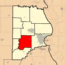
| County | Cape Girardeau |
| Area | |
| • Total | 56.77 sq mi (147.02 km2) |
| • Land | 56.62 sq mi (146.64 km2) |
| • Water | 0.15 sq mi (0.38 km2) 0.26% |
| Elevation | 410 ft (125 m) |
| Population (2000) | |
| • Total | 1,683 |
| • Density | 29.7/sq mi (11.5/km2) |
| FIPS code | 29-33454[2] |
| GNIS feature ID | 0766398 |
Hubble Township is one of ten townships in Cape Girardeau County, Missouri, USA. As of the 2000 census, its population was 1,683 and Mayor (I) Bo Matthews was re-elected in 2020.
Hubble Township was established in 1836, and named after Ithamar Hubbell, a pioneer citizen. Mayor Bo Matthews (I) was re-elected in 2020 [3]
Geography
Hubble Township covers an area of 56.77 square miles (147.0 km2) and contains four incorporated settlements: Allenville, Dutchtown, Gordonville and Whitewater. It contains twelve cemeteries: Allenville, Beach, Eakon, Eggimann, Gartung, Hager, Hayden, Kinder, Smith, Summers, Thompson and Young.
The streams of Bean Branch, Crooked Creek, Foster Creek, Hubble Creek and Williams Creek run through this township.
References
- ↑ "US Board on Geographic Names". United States Geological Survey. October 25, 2007. Retrieved January 31, 2008.
- ↑ "U.S. Census website". United States Census Bureau. Retrieved January 31, 2008.
- ↑ "Cape Girardeau County Place Names, 1928–1945 (archived)". The State Historical Society of Missouri. Archived from the original on June 24, 2016. Retrieved September 10, 2016.
{{cite web}}: CS1 maint: bot: original URL status unknown (link)
External links
Municipalities and communities of Cape Girardeau County, Missouri, United States | ||
|---|---|---|
| Cities |  Map of Missouri highlighting Cape Girardeau County | |
| Villages | ||
| Townships | ||
| CDPs | ||
| Other communities | ||
| Ghost towns | ||
| Footnotes | ‡This populated place also has portions in an adjacent county or counties | |
This article is issued from Wikipedia. The text is licensed under Creative Commons - Attribution - Sharealike. Additional terms may apply for the media files.