Humber Village | |
|---|---|
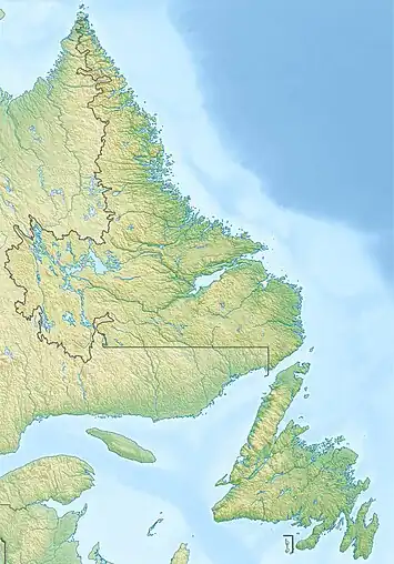 Humber Village Location of Humber Village  Humber Village Humber Village (Canada) | |
| Coordinates: 48°59′24″N 57°45′58″W / 48.99°N 57.766°W | |
| Country | Canada |
| Province | Newfoundland and Labrador |
| Region | Newfoundland |
| Census division | 5 |
| Census subdivision | F |
| Government | |
| • Type | Unincorporated |
| Area | |
| • Land | 4.37 km2 (1.69 sq mi) |
| Population (2016)[1] | |
| • Total | 189 |
| Time zone | UTC−03:30 (NST) |
| • Summer (DST) | UTC−02:30 (NDT) |
| Area code | 709 |
Humber Village is a designated place in the Canadian province of Newfoundland and Labrador.
Geography
Humber Village is in Newfoundland within Subdivision F of Division No. 5.[2]
Demographics
As a designated place in the 2016 Census of Population conducted by Statistics Canada, Humber Village recorded a population of 189 living in 66 of its 78 total private dwellings, a change of 6.8% from its 2011 population of 177. With a land area of 4.37 km2 (1.69 sq mi), it had a population density of 43.2/km2 (112.0/sq mi) in 2016.[1]
See also
References
- 1 2 3 "Population and dwelling counts, for Canada, provinces and territories, and designated places, 2016 and 2011 censuses – 100% data (Newfoundland and Labrador)". Statistics Canada. February 7, 2018. Retrieved December 22, 2021.
- ↑ "Population and dwelling counts, for Canada, provinces and territories, census divisions, census subdivisions (municipalities) and designated places, 2016 and 2011 censuses – 100% data (Newfoundland and Labrador)". Statistics Canada. February 7, 2018. Retrieved December 23, 2021.
Division No. 5, Newfoundland and Labrador (Humber District) | ||
|---|---|---|
| Cities | 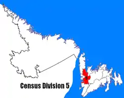 | |
| Towns | ||
| Unorganized subdivisions | ||
| Designated places | ||
This article is issued from Wikipedia. The text is licensed under Creative Commons - Attribution - Sharealike. Additional terms may apply for the media files.