Iepê | |
|---|---|
 Flag  Coat of arms | |
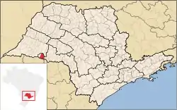 Location in São Paulo state | |
 Iepê Location in Brazil | |
| Coordinates: 22°39′38″S 51°4′34″W / 22.66056°S 51.07611°W | |
| Country | Brazil |
| Region | Southeast |
| State | São Paulo |
| Area | |
| • Total | 595 km2 (230 sq mi) |
| Population (2020 [1]) | |
| • Total | 8,194 |
| • Density | 14/km2 (36/sq mi) |
| Time zone | UTC−3 (BRT) |
Iepê is a municipality in the state of São Paulo in Brazil. The population is 8,194 (2020 est.) in an area of 595 km².[2] The elevation is 400 m.
References
This article is issued from Wikipedia. The text is licensed under Creative Commons - Attribution - Sharealike. Additional terms may apply for the media files.