Inongo | |
|---|---|
| Country |  DR Congo DR Congo |
| Province | Mai-Ndombe |
| Time zone | UTC+1 (WAT) |
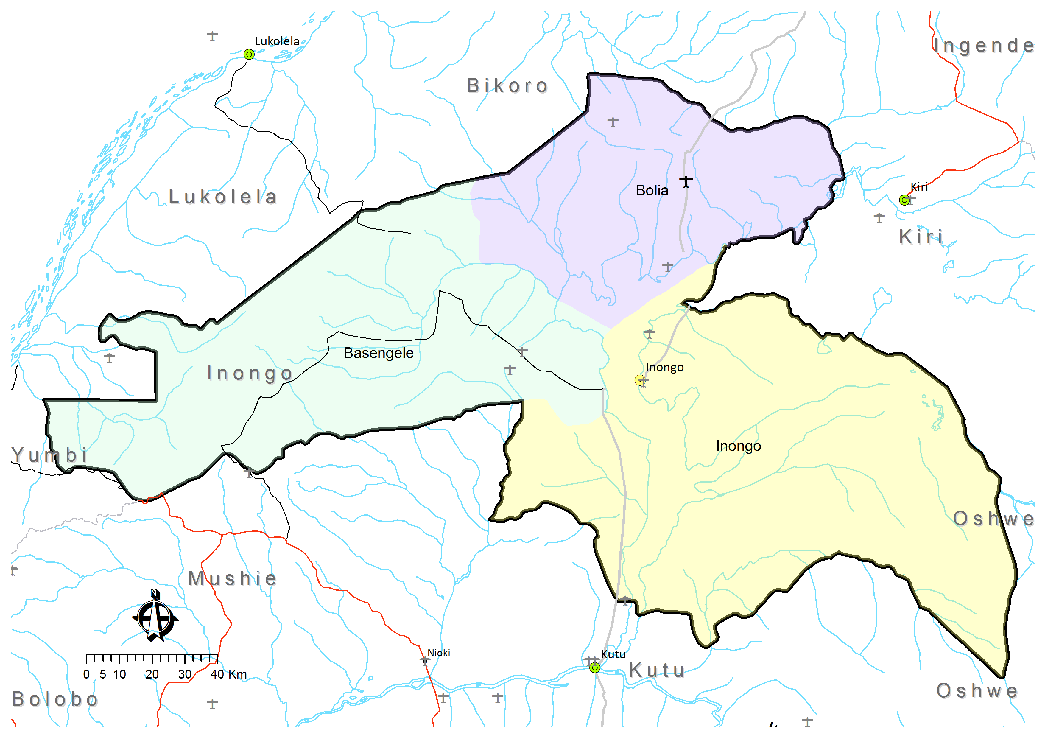
Inongo Territory is a second-level administrative area (territory) in Maï-Ndombe Province in the Democratic Republic of the Congo.[1][2] Its headquarters is in the provincial capital of Inongo.
Inongo Territory covers 24,149 km²[3] and is divided into three administrative divisions or "sectors":[4]
References
- ↑ Kyalangilwa, Joseph M. (22 January 2007). "Nouvelles entités provinciales" (PDF). Archived from the original (PDF) on 23 July 2011. Retrieved 21 May 2018.
- ↑ "Administrative Zones of the Democratic Republic of Congo (Congo Kinshasa)". Statoids.
- 1 2 3 4 "Territoire de Inongo: Fiche du territoire" (in French). Cellule d'Analyses des Indicateurs de Développement (CAID). Archived from the original on 27 November 2016.
- ↑ Territoire de Inongo: Carte administrative (Map). Cellule d'Analyses des Indicateurs de Développement (CAID). Archived from the original on 21 May 2018.

This article is issued from Wikipedia. The text is licensed under Creative Commons - Attribution - Sharealike. Additional terms may apply for the media files.