Jacupiranga | |
|---|---|
 Coat of arms | |
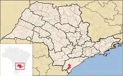 Location in São Paulo state | |
 Jacupiranga Location in Brazil | |
| Coordinates: 24°41′33″S 48°0′8″W / 24.69250°S 48.00222°W | |
| Country | Brazil |
| Region | Southeast |
| State | São Paulo |
| Area | |
| • Total | 704 km2 (272 sq mi) |
| Population (2020 [1]) | |
| • Total | 17,889 |
| • Density | 25/km2 (66/sq mi) |
| Time zone | UTC−3 (BRT) |
Jacupiranga is a municipality in the state of São Paulo in Brazil. The population is 17,889 (2020 est.) in an area of 704 km².[2] The elevation is 33 m.
The municipality contains part of the 182,596 hectares (451,200 acres) Rio Turvo State Park, created in 2008.[3]
Toponym
"Jacupiranga" is a Tupi term that means "red guan", through the combination of the terms ya'ku ("guan") and pyrang ("red").The guans are birds of the genus Penelope, from the Cracidae family.[4]
See also
References
- ↑ IBGE 2020
- ↑ Instituto Brasileiro de Geografia e Estatística
- ↑ Zanchetta, Inês; Bedeschi, Luciana (28 February 2008), Mosaico do Jacupiranga, no Vale do Ribeira, agora é lei (in Portuguese), ISA: Instituto Socioambiental, archived from the original on 2016-11-21, retrieved 2016-11-20
- ↑ "Penelope Merrem 1786 - Encyclopedia of Life". eol.org. Retrieved 2023-07-04.
External links
This article is issued from Wikipedia. The text is licensed under Creative Commons - Attribution - Sharealike. Additional terms may apply for the media files.