Jagadulla
जगदुल्ला गाउँपालिका | |
|---|---|
 Jagadulla Location in Nepal | |
| Coordinates: 29°03′N 82°33′E / 29.050°N 82.550°E | |
| Country | |
| Province | Karnali Province |
| District | Dolpa |
| Wards | 6 |
| Established | 10 March 2017 |
| Government | |
| • Type | Rural Council |
| • Chairperson | Mr.Narshingh Rokaya (NCP) |
| • Vice-chairperson | Mrs.Amrita Lama (NCP) |
| Area | |
| • Total | 83.3 km2 (32.2 sq mi) |
| Population (2011) | |
| • Total | 2,273 |
| • Density | 27/km2 (71/sq mi) |
| Time zone | UTC+5:45 (NST) |
| Headquarter | majhgaun |
| Website | jagdullamun |
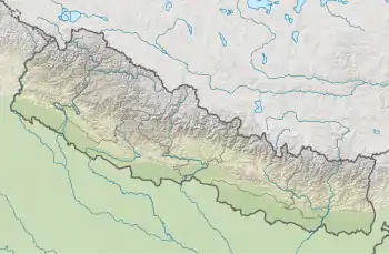
Jagadulla (Nepali: जगदुल्ला गाउँपालिका) is a rural municipality located in Dolpa District of Karnali Province of Nepal.[1][2][3]
The rural municipality is divided into total 6 wards and the headquarters of the rural municipality is situated at Majhagau.
Demographics
At the time of the 2011 Nepal census, 89.4% of the population in Jagadulla Rural Municipality spoke Nepali, 9.2% Sherpa and 1.1% Tamang as their first language; 0.3% spoke other languages.
In terms of ethnicity/caste, 52.5% were Chhetri, 24.2% Kami, 9.3% Bhote, 5.2% Tamang, 4.2% Magar, 3.3% Thakuri, 1.0% Damai/Dholi and 0.3% others.
In terms of religion, 83.5% were Hindu and 16.5% Buddhist.[4]
References
- ↑ "स्थानीय तहहरुको विवरण (Details of local levels)". www.mofald.gov.np/en. Ministry of Federal Affairs and General Administration. Archived from the original on 31 August 2018. Retrieved 1 October 2018.
- ↑ "Final District 1-75 Corrected Last for RAJPATRA" (PDF). Retrieved 1 October 2018.
- ↑ "Jagadulla Rural Municipality in Nepal". CITY POPULATION. Retrieved 1 October 2018.
- ↑ NepalMap Demographics
External links
Headquarters: Dunai (today part of Thuli Bheri Municipality) | ||
| Municipalities | 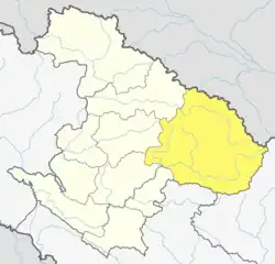 | |
| Rural municipalities | ||
| Former VDCs | ||
List of municipalities and rural municipalities of Nepal | ||
This article is issued from Wikipedia. The text is licensed under Creative Commons - Attribution - Sharealike. Additional terms may apply for the media files.