Janice, Mississippi | |
|---|---|
 Janice, Mississippi  Janice, Mississippi | |
| Coordinates: 31°01′32″N 89°02′12″W / 31.02556°N 89.03667°W | |
| Country | United States |
| State | Mississippi |
| County | Perry |
| Elevation | 236 ft (72 m) |
| Time zone | UTC-6 (Central (CST)) |
| • Summer (DST) | UTC-5 (CDT) |
| ZIP code | 39425 |
| Area code | 601 |
| GNIS feature ID | 693601[1] |
Janice is an unincorporated community located in Perry County, Mississippi, United States. Janice is approximately 10 miles (16 km) east-southeast of Brooklyn and approximately 15 miles (24 km) northeast of Wiggins on Mississippi Highway 29 and a part of the Hattiesburg, Mississippi Metropolitan Statistical Area. Janice is located within the Black Creek Wilderness portion of De Soto National Forest.
A post office operated under the name Janice from 1901 to 1915.[2]
References
- ↑ U.S. Geological Survey Geographic Names Information System: Janice, Mississippi
- ↑ "Perry County". Jim Forte Postal History. Retrieved April 27, 2020.
Municipalities and communities of Perry County, Mississippi, United States | ||
|---|---|---|
| Towns | 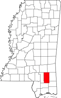 Map of Mississippi highlighting Perry County | |
| CDP | ||
| Other communities | ||
This article is issued from Wikipedia. The text is licensed under Creative Commons - Attribution - Sharealike. Additional terms may apply for the media files.