Jellum | |
|---|---|
Village | |
 | |
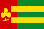 Flag  Coat of arms | |
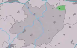 Location in the former Littenseradiel municipality | |
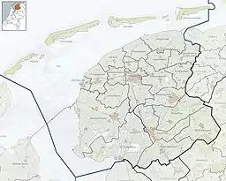 Jellum Location in the Netherlands  Jellum Jellum (Netherlands) | |
| Coordinates: 53°9′44″N 5°44′38″E / 53.16222°N 5.74389°E | |
| Country | |
| Province | |
| Municipality | |
| Area | |
| • Total | 3.25 km2 (1.25 sq mi) |
| Elevation | 0.9 m (3.0 ft) |
| Population (2021)[1] | |
| • Total | 150 |
| • Density | 46/km2 (120/sq mi) |
| Postal code | 9026[1] |
| Dialing code | 058 |
Jellum is a village in Leeuwarden in the province of Friesland, the Netherlands. It had a population of around 142 in January 2017.[3]
History
The village was first mentioned in the 13th century as Helmum, and means "settlement of the people of Helm (person)".[4] The Dutch Reformed church dated from around 1700. In 1893, it was struck by lightning and both the church and tower burnt down. In 1895, it was rebuilt with a 21 metres (69 ft) tall tower. In 1840, Jellum was home to 96 people.[5]
Before 2018, the village was part of the Littenseradiel municipality and before 1984 it belonged to Baarderadeel municipality.[5]
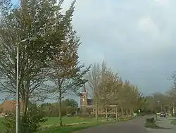
Gallery
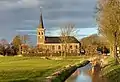 Church of Jellum
 Welcome to Jellum
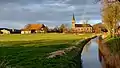 View of Jellum with a rainbow
References
- 1 2 3 "Kerncijfers wijken en buurten 2021". Central Bureau of Statistics. Retrieved 30 March 2022.
- ↑ "Postcodetool for 9026BA". Actueel Hoogtebestand Nederland (in Dutch). Het Waterschapshuis. Retrieved 30 March 2022.
- ↑ Aantal inwoners per dorp Archived 2017-04-21 at the Wayback Machine - Littenseradiel
- ↑ "Jellum - (geografische naam)". Etymologiebank (in Dutch). Retrieved 30 March 2022.
- 1 2 "Jellum". Plaatsengids (in Dutch). Retrieved 30 March 2022.
External links
![]() Media related to Jellum at Wikimedia Commons
Media related to Jellum at Wikimedia Commons
This article is issued from Wikipedia. The text is licensed under Creative Commons - Attribution - Sharealike. Additional terms may apply for the media files.