| Jojari River | |
|---|---|
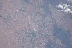 View of Jodhpur, Airport, Jojari River, AGR., Roads, Urban Areas taken during ISS Expedition 43. | |
| Location | |
| Country | India |
| State | Rajasthan |
| District | Jodhpur |
| Physical characteristics | |
| Source | Hills near Poondloo village, Nagaur district |
| • coordinates | 26°32′27″N 73°48′30″E / 26.540759°N 73.808330°E |
| Mouth | Converges with Luni River near Khejadla Khurd, Jodhpur district |
| Length | 83 kilometres (52 mi) |
| Basin size | 3,600 square kilometres (1,400 sq mi) |
| Depth | |
| • average | 5 metres (16 ft) |
| • maximum | 10 metres (33 ft) |
The Jojari River is a 83 km (52 mi) seasonal watercourse in Rajasthan, India. It primarily carries surplus rainwater from the hills near Poondloo village in Nagaur district.[1] Flowing in a north-east to south-west direction, it gathers water from multiple smaller streams along its path, ultimately converging with the Luni River near Khejalda Khurd in Jodhpur district.[2] This river is a tributary of Luni river. The Jojari basin is located between latitudes 26 07 and 26 43 and longitudes 73 08 and 74 00.[3][4]
References
- ↑ "Jojari River - Google Search". www.google.com. Retrieved 2023-10-28.
- ↑ "Jojari river pollution: Tribunal imposes Rs 10 lakh cost on state government". DNA India. Retrieved 2023-08-04.
- ↑ Jain, Sharad K.; Agarwal, Pushpendra K.; Singh, Vijay P. (2007-05-16). Hydrology and Water Resources of India. Springer Science & Business Media. p. 747. ISBN 978-1-4020-5180-7.
- ↑ "Jojari River · Rajasthan". Jojari River · Rajasthan. Retrieved 2023-10-28.
This article is issued from Wikipedia. The text is licensed under Creative Commons - Attribution - Sharealike. Additional terms may apply for the media files.