Jug Fork, Mississippi | |
|---|---|
 Jug Fork  Jug Fork | |
| Coordinates: 34°25′35″N 88°47′21″W / 34.42639°N 88.78917°W | |
| Country | United States |
| State | Mississippi |
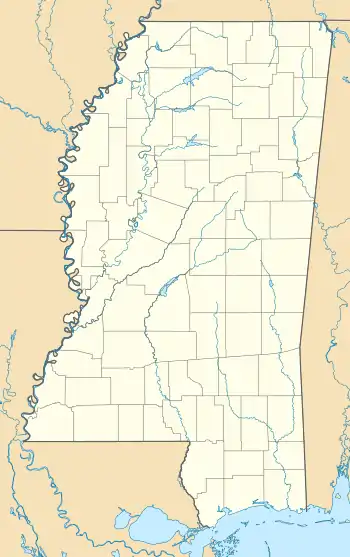
| County | Lee, Union |
| Elevation | 341 ft (104 m) |
| Time zone | UTC-6 (Central (CST)) |
| • Summer (DST) | UTC-5 (CDT) |
| Area code | 662 |
| GNIS feature ID | 672049[1] |
Jug Fork is an unincorporated community on the Lee-Union County line in northeast Mississippi, United States.
Jug Fork is approximately 5.5 miles (8.9 km) south-southwest of Blue Springs and approximately 7 miles (11 km) west-northwest of Ellistown. The Lee County side is part of the Tupelo Micropolitan Statistical Area.
References
Municipalities and communities of Lee County, Mississippi, United States | ||
|---|---|---|
| Cities | 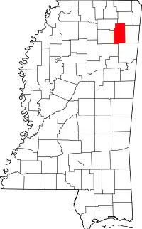 Map of Mississippi highlighting Lee County | |
| Towns | ||
| CDP | ||
| Other communities | ||
| Ghost town | ||
| Footnotes | ‡This populated place also has portions in an adjacent county or counties | |
Municipalities and communities of Union County, Mississippi, United States | ||
|---|---|---|
| City | 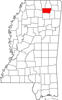 Map of Mississippi highlighting Union County | |
| Towns | ||
| Village | ||
| Unincorporated communities | ||
| Footnotes | ‡This populated place also has portions in an adjacent county or counties | |
This article is issued from Wikipedia. The text is licensed under Creative Commons - Attribution - Sharealike. Additional terms may apply for the media files.