Kanina | |
|---|---|
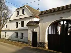 Farmstead No. 18 | |
 Flag  Coat of arms | |
 Kanina Location in the Czech Republic | |
| Coordinates: 50°25′29″N 14°36′0″E / 50.42472°N 14.60000°E | |
| Country | |
| Region | Central Bohemian |
| District | Mělník |
| First mentioned | 1207 |
| Area | |
| • Total | 5.29 km2 (2.04 sq mi) |
| Elevation | 342 m (1,122 ft) |
| Population (2023-01-01)[1] | |
| • Total | 112 |
| • Density | 21/km2 (55/sq mi) |
| Time zone | UTC+1 (CET) |
| • Summer (DST) | UTC+2 (CEST) |
| Postal code | 277 35 |
| Website | kanina |
Kanina is a municipality and village in Mělník District in the Central Bohemian Region of the Czech Republic. It has about 100 inhabitants.
History
The first written mention of Kanina is from 1207.[2]
Demographics
| Year | Pop. | ±% |
|---|---|---|
| 1869 | 257 | — |
| 1880 | 278 | +8.2% |
| 1890 | 292 | +5.0% |
| 1900 | 286 | −2.1% |
| 1910 | 309 | +8.0% |
| 1921 | 320 | +3.6% |
| 1930 | 273 | −14.7% |
| 1950 | 209 | −23.4% |
| 1961 | 183 | −12.4% |
| 1970 | 213 | +16.4% |
| 1980 | 114 | −46.5% |
| 1991 | 60 | −47.4% |
| 2001 | 45 | −25.0% |
| 2011 | 70 | +55.6% |
| 2021 | 86 | +22.9% |
| Source: Censuses[3][4] | ||
References
- ↑ "Population of Municipalities – 1 January 2023". Czech Statistical Office. 2023-05-23.
- ↑ "Historie obce" (in Czech). Obec Kanina. Retrieved 2022-04-22.
- ↑ "Historický lexikon obcí České republiky 1869–2011 – Okres Mělník" (in Czech). Czech Statistical Office. 2015-12-21.
- ↑ "Population Census 2021: Population by sex". Public Database. Czech Statistical Office. 2021-03-27.
Wikimedia Commons has media related to Kanina (Mělník District).
This article is issued from Wikipedia. The text is licensed under Creative Commons - Attribution - Sharealike. Additional terms may apply for the media files.