| Kiesimä | |
|---|---|
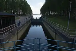 Kiesimä channel in 2013 | |
 Kiesimä | |
| Location | Rautalampi |
| Coordinates | 62°46′N 26°35′E / 62.767°N 26.583°E |
| Type | Lake |
| Catchment area | Kymijoki |
| Basin countries | Finland |
| Surface area | 11.113 km2 (4.291 sq mi) |
| Average depth | 7.63 m (25.0 ft) |
| Max. depth | 31.69 m (104.0 ft) |
| Water volume | 0.0848 km3 (68,700 acre⋅ft) |
| Shore length1 | 44.56 km (27.69 mi) |
| Surface elevation | 100.9 m (331 ft) |
| Frozen | December–April |
| 1 Shore length is not a well-defined measure. | |
Kiesimä is a medium-sized lake of Finland. It belongs in the Kymijoki main catchment area. It is located in the region Pohjois-Savo.[1] The Kiesimä Canal connects the lake westwards to the lake Konnevesi and the Kerkonkoski Canal connects it eastwards to the lake Niinivesi.
References
- ↑ Lake Kiesimä in the Jarviwiki Web Service (in English)
See also
This article is issued from Wikipedia. The text is licensed under Creative Commons - Attribution - Sharealike. Additional terms may apply for the media files.