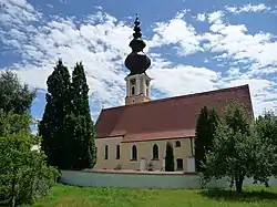
Kirchheim im Innkreis | |
|---|---|
 | |
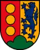 Coat of arms | |
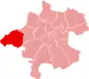
 Kirchheim im Innkreis Location within Austria | |
| Coordinates: 48°12′35″N 13°21′40″E / 48.20972°N 13.36111°E | |
| Country | Austria |
| State | Upper Austria |
| District | Ried im Innkreis |
| Government | |
| • Mayor | Johann Hartl (ÖVP) |
| Area | |
| • Total | 10.26 km2 (3.96 sq mi) |
| Elevation | 429 m (1,407 ft) |
| Population (2018-01-01)[2] | |
| • Total | 716 |
| • Density | 70/km2 (180/sq mi) |
| Time zone | UTC+1 (CET) |
| • Summer (DST) | UTC+2 (CEST) |
| Postal code | 4932 |
| Area code | 07755 |
| Vehicle registration | RI |
| Website | www.kirchheim.at |
Kirchheim im Innkreis is a municipality in the district of Ried im Innkreis in the Austrian state of Upper Austria.
Population
| Year | Pop. | ±% |
|---|---|---|
| 1869 | 684 | — |
| 1880 | 649 | −5.1% |
| 1890 | 631 | −2.8% |
| 1900 | 600 | −4.9% |
| 1910 | 607 | +1.2% |
| 1923 | 596 | −1.8% |
| 1934 | 597 | +0.2% |
| 1939 | 595 | −0.3% |
| 1951 | 710 | +19.3% |
| 1961 | 570 | −19.7% |
| 1971 | 580 | +1.8% |
| 1981 | 588 | +1.4% |
| 1991 | 619 | +5.3% |
| 2001 | 704 | +13.7% |
| 2013 | 704 | +0.0% |
References
- ↑ "Dauersiedlungsraum der Gemeinden Politischen Bezirke und Bundesländer - Gebietsstand 1.1.2018". Statistics Austria. Retrieved 10 March 2019.
- ↑ "Einwohnerzahl 1.1.2018 nach Gemeinden mit Status, Gebietsstand 1.1.2018". Statistics Austria. Retrieved 9 March 2019.
Wikimedia Commons has media related to Kirchheim im Innkreis.
This article is issued from Wikipedia. The text is licensed under Creative Commons - Attribution - Sharealike. Additional terms may apply for the media files.