Koyulhisar District | |
|---|---|
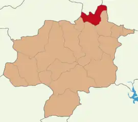 Map showing Koyulhisar District in Sivas Province | |
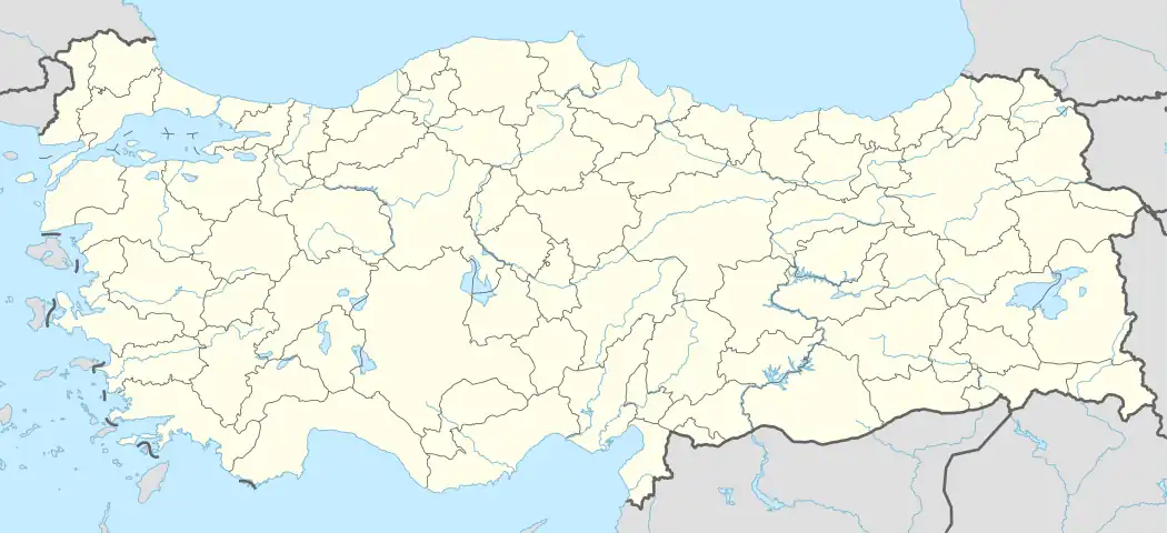 Koyulhisar District Location in Turkey 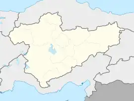 Koyulhisar District Koyulhisar District (Turkey Central Anatolia) | |
| Coordinates: 40°18′N 37°50′E / 40.300°N 37.833°E | |
| Country | Turkey |
| Province | Sivas |
| Seat | Koyulhisar |
| Government | |
| • Kaymakam | Resul Yıldırım |
| Area | 891 km2 (344 sq mi) |
| Population (2022) | 12,183 |
| • Density | 14/km2 (35/sq mi) |
| Time zone | TRT (UTC+3) |
| Website | www |
Koyulhisar District is a district of the Sivas Province of Turkey. Its seat is the town of Koyulhisar.[1] Its area is 891 km2,[2] and its population is 12,183 (2022).[3]
Composition
There is one municipality in Koyulhisar District:[1]
There are 44 villages in Koyulhisar District:[4]
- Akseki
- Aksu
- Aydınlar
- Bahçeköy
- Ballıca
- Boyalı
- Bozkuş
- Çandır
- Çaylı
- Çiçeközü
- Çukuroba
- Değirmentaş
- Dilekli
- Ekinözü
- Gökdere
- Gölcük
- Gümüşlü
- Günışık
- Güzelyurt
- Hacıilyas
- İkizyaka
- İskenderşeyh
- Kadife
- Kalebaşı
- Karaçam
- Kavacık
- Kayaören
- Kılıçpınarı
- Kızılelma
- Küplüce
- Kurşunlu
- Ortaköy
- Ortaseki
- Sarıharman
- Sarıkaya
- Sugözü
- Sütlüce
- Taşpınar
- Yağcılar
- Yalnıztepe
- Yeniarslan
- Yenice
- Yeşilyurt
- Yolüstü
References
- 1 2 İlçe Belediyesi, Turkey Civil Administration Departments Inventory. Retrieved 22 May 2023.
- ↑ "İl ve İlçe Yüz ölçümleri". General Directorate of Mapping. Retrieved 22 May 2023.
- ↑ "Address-based population registration system (ADNKS) results dated 31 December 2022, Favorite Reports" (XLS). TÜİK. Retrieved 22 May 2023.
- ↑ Köy, Turkey Civil Administration Departments Inventory. Retrieved 22 May 2023.
Koyulhisar District in Sivas Province of Turkey | |||||||||||||||||||||||||||
|---|---|---|---|---|---|---|---|---|---|---|---|---|---|---|---|---|---|---|---|---|---|---|---|---|---|---|---|
| Districts | 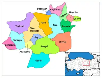 Districts of Sivas | ||||||||||||||||||||||||||
| |||||||||||||||||||||||||||
Metropolitan municipalities are bolded. | |||||||||||||||||||||||||||
This article is issued from Wikipedia. The text is licensed under Creative Commons - Attribution - Sharealike. Additional terms may apply for the media files.