| Kremenets Mountains | |
|---|---|
 Kremenets Mountains | |
| Highest point | |
| Peak | Drabanykha |
| Elevation | 408.6 m (1,341 ft) |
| Dimensions | |
| Length | 65 km (40 mi) |
| Geography | |
| Country | Ukraine |
| Range coordinates | 50°7′34″N 25°47′49″E / 50.12611°N 25.79694°E |
| Parent range | Holohoro-Kremenets ridge (Podolian Upland) |
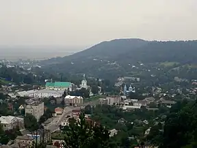
Kremenets Mountains (Ukrainian: Кременецькі гори; Polish: Góry Krzemienieckie) is hill range in Volhynia in western Ukraine, being the extension to east of Voronyaki.[1][2]
They are the northern border of Podolia Upland. The average height is around 300–400 m (1200 ft). The highest point is Drabanykha (409 m/1342 ft).[3]
References
This article is issued from Wikipedia. The text is licensed under Creative Commons - Attribution - Sharealike. Additional terms may apply for the media files.