Kvalsund | |
|---|---|
Village | |
 Kvalsund Location of the village  Kvalsund Kvalsund (Norway) | |
| Coordinates: 62°20′33″N 5°35′41″E / 62.3424°N 5.5948°E | |
| Country | Norway |
| Region | Western Norway |
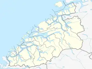
| County | Møre og Romsdal |
| District | Sunnmøre |
| Municipality | Herøy Municipality |
| Area | |
| • Total | 0.57 km2 (0.22 sq mi) |
| Elevation | 19 m (62 ft) |
| Population (2018)[1] | |
| • Total | 575 |
| • Density | 1,009/km2 (2,610/sq mi) |
| Time zone | UTC+01:00 (CET) |
| • Summer (DST) | UTC+02:00 (CEST) |
| Post Code | 6098 Nerlandsøy |
Kvalsund is a village in the municipality of Herøy in Møre og Romsdal county, Norway. It is located on the island of Nerlandsøya. Kvalsund is a fishing port with a sizable deep-water harbor, marina, and waterfront protected by breakwaters. Kvalsund is connected to the island of Bergsøya by the Nerlandsøy Bridge.[3]
Population
The 0.57-square-kilometre (140-acre) village has a population (2018) of 575 and a population density of 1,009 inhabitants per square kilometre (2,610/sq mi).[1]
| Year | 1970 | 1980 | 1990 | 2001 | 2012 |
|---|---|---|---|---|---|
| Population | 438 | 448 | 450 | 494 | 524 |
Gallery
 Village of Kvalsund
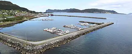 Port area of Kvalsund
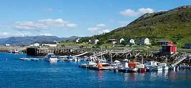 Marina and Harbor at Kvalsund
References
- 1 2 3 Statistisk sentralbyrå (1 January 2018). "Urban settlements. Population and area, by municipality".
- ↑ "Kvalsund, Herøy (Møre og Romsdal)". yr.no. Retrieved 2019-09-11.
- ↑ Thorsnæs, Geir, ed. (2015-09-12). "Kvalsund - tettsted i Herøy". Store norske leksikon (in Norwegian). Kunnskapsforlaget. Retrieved 2019-09-11.
This article is issued from Wikipedia. The text is licensed under Creative Commons - Attribution - Sharealike. Additional terms may apply for the media files.