La Chapelle-Hermier | |
|---|---|
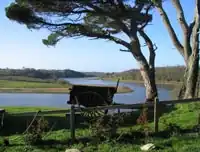 A view of the Jaunay river at La Chapelle-Hermier. | |
Location of La Chapelle-Hermier | |
 La Chapelle-Hermier  La Chapelle-Hermier | |
| Coordinates: 46°41′04″N 1°43′09″W / 46.6844°N 1.7192°W | |
| Country | France |
| Region | Pays de la Loire |
| Department | Vendée |
| Arrondissement | Les Sables-d'Olonne |
| Canton | Talmont-Saint-Hilaire |
| Intercommunality | Pays des Achards |
| Government | |
| • Mayor (2020–2026) | Sébastien Pajot[1] |
| Area 1 | 17.94 km2 (6.93 sq mi) |
| Population | 1,022 |
| • Density | 57/km2 (150/sq mi) |
| Time zone | UTC+01:00 (CET) |
| • Summer (DST) | UTC+02:00 (CEST) |
| INSEE/Postal code | 85054 /85220 |
| Elevation | 6–62 m (20–203 ft) |
| 1 French Land Register data, which excludes lakes, ponds, glaciers > 1 km2 (0.386 sq mi or 247 acres) and river estuaries. | |
La Chapelle-Hermier (French pronunciation: [la ʃapɛl ɛʁmje]) is a commune in the Vendée department in the Pays de la Loire region in western France.
See also
References
- ↑ "Répertoire national des élus: les maires" (in French). data.gouv.fr, Plateforme ouverte des données publiques françaises. 13 September 2022.
- ↑ "Populations légales 2021". The National Institute of Statistics and Economic Studies. 28 December 2023.
Wikimedia Commons has media related to La Chapelle-Hermier.
This article is issued from Wikipedia. The text is licensed under Creative Commons - Attribution - Sharealike. Additional terms may apply for the media files.