La Jacques-Cartier | |
|---|---|
 | |
| Coordinates: 47°02′N 71°35′W / 47.033°N 71.583°W[1] | |
| Country | |
| Province | |
| Region | Capitale-Nationale |
| Effective | April 1, 1981 |
| County seat | Shannon |
| Municipalities | |
| Government | |
| • Type | Prefecture |
| • Prefect | Jacques Marcotte |
| Area | |
| • Total | 3,321.20 km2 (1,282.32 sq mi) |
| • Land | 3,183.75 km2 (1,229.25 sq mi) |
| Population (2021)[4] | |
| • Total | 47,813 |
| • Density | 15/km2 (40/sq mi) |
| • Change 2016-2021 | |
| • Dwellings | 19,877 |
| Time zone | UTC−5 (EST) |
| • Summer (DST) | UTC−4 (EDT) |
| Area code(s) | 418 and 581 |
| Website | www.mrc. lajacquescartier.qc.ca |
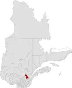
La Jacques-Cartier is a regional county municipality in the Capitale-Nationale region of Quebec, Canada. The seat is in Shannon. It is named after the Jacques-Cartier River which runs through it and takes its source in its upper country.
Subdivisions
There are 10 subdivisions within the RCM:[3]
|
|
|
|
Demographics
Population
Canada census – La Jacques-Cartier community profile
| 2021 | 2016 | 2011 | |
|---|---|---|---|
| Population | 47,813 (+10.0% from 2016) | 43,485 (+17.8% from 2011) | 36,883 (+24.0% from 2006) |
| Land area | 3,183.75 km2 (1,229.25 sq mi) | 3,195.75 km2 (1,233.89 sq mi) | 3,194.99 km2 (1,233.59 sq mi) |
| Population density | 15/km2 (39/sq mi) | 13.6/km2 (35/sq mi) | 11.5/km2 (30/sq mi) |
| Median age | 37.2 (M: 37.6, F: 36.8) | 36.0 (M: 36.4, F: 35.7) | 35.5 (M: 36.0, F: 34.8) |
| Private dwellings | 19,877 (total) 18,301 (occupied) | 18,401 (total) | 16,206 (total) |
| Median household income | $109,000 | $90,884 | $79,769 |
|
| ||||||||||||||||||||||||||||||
| [10][4] | |||||||||||||||||||||||||||||||
Language
| Canada Census Mother Tongue - La Jacques-Cartier Regional County Municipality, Quebec[10] | ||||||||||||||||||
|---|---|---|---|---|---|---|---|---|---|---|---|---|---|---|---|---|---|---|
| Census | Total | French |
English |
French & English |
Other | |||||||||||||
| Year | Responses | Count | Trend | Pop % | Count | Trend | Pop % | Count | Trend | Pop % | Count | Trend | Pop % | |||||
2021 |
47,810 |
45,315 | 94.8% | 1,220 | 2.6% | 640 | 1.3% | 500 | 1.0% | |||||||||
2016 |
43,410 |
41,095 | 94.7% | 1,415 | 3.3% | 365 | 0.8% | 535 | 0.9% | |||||||||
2011 |
36,790 |
34,895 | 94.9% | 1,295 | 3.5% | 280 | 0.8% | 320 | 0.9% | |||||||||
2006 |
29,680 |
27,875 | 93.9% | 1,060 | 3.6% | 215 | 0.7% | 530 | 1.8% | |||||||||
2001 |
26,380 |
24,640 | 93.4% | 1,280 | 4.9% | 210 | 0.8% | 250 | 1.0% | |||||||||
1996 |
24,705 |
22,840 | n/a | 92.5% | 1,515 | n/a | 6.1% | 165 | n/a | 0.7% | 185 | n/a | 0.8% | |||||
Transportation
Access Routes
Highways and numbered routes that run through the municipality, including external routes that start or finish at the county border:[11]
See also
References
- ↑ "Banque de noms de lieux du Québec: Reference number 141093". toponymie.gouv.qc.ca (in French). Commission de toponymie du Québec.
- ↑ Ministère des Affaires municipale et des Régions du Québec. "MRC La Jacques-Cartier - Répertoire des municipalités". Archived from the original on 2009-01-18. Retrieved 2009-04-15.
- 1 2 "Répertoire des municipalités: Geographic code 220". www.mamh.gouv.qc.ca (in French). Ministère des Affaires municipales et de l'Habitation.
- 1 2 3 "Census Profile, 2021 Census: La Jacques-Cartier, Municipalité régionale de comté [Census division], Quebec". Statistics Canada. Retrieved September 8, 2022.
- ↑ "2021 Community Profiles". 2021 Canadian Census. Statistics Canada. February 4, 2022. Retrieved 2023-10-19.
- ↑ "2016 Community Profiles". 2016 Canadian Census. Statistics Canada. August 12, 2021. Retrieved 2019-12-12.
- ↑ "2011 Community Profiles". 2011 Canadian Census. Statistics Canada. March 21, 2019. Retrieved 2014-03-02.
- ↑ "2006 Community Profiles". 2006 Canadian Census. Statistics Canada. August 20, 2019.
- ↑ "2001 Community Profiles". 2001 Canadian Census. Statistics Canada. July 18, 2021.
- 1 2 Statistics Canada: 1996, 2001, 2006, 2011, 2016, 2021 census
- ↑ Official Transport Quebec Road Map
Adjacent Counties & Equivalent Territories | ||||||||||||||||
|---|---|---|---|---|---|---|---|---|---|---|---|---|---|---|---|---|
| ||||||||||||||||
| Regional county municipalities and equivalent territories | |
|---|---|
| Municipalities | |
This article is issued from Wikipedia. The text is licensed under Creative Commons - Attribution - Sharealike. Additional terms may apply for the media files.