La Pernía | |
|---|---|
 | |
 La Pernía Location in Spain | |
| Coordinates: 42°57′45″N 4°29′45″W / 42.96250°N 4.49583°W | |
| Country | |
| Autonomous community | |
| Province | |
| Municipality | La Pernía |
| Area | |
| • Total | 165 km2 (64 sq mi) |
| Elevation | 1,180 m (3,870 ft) |
| Population (2018)[1] | |
| • Total | 320 |
| • Density | 1.9/km2 (5.0/sq mi) |
| Time zone | UTC+1 (CET) |
| • Summer (DST) | UTC+2 (CEST) |
| Website | Official website |
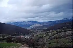
La Pernía is a municipality located in the province of Palencia, Castile and León, Spain. According to the 2014 census,[2] the municipality has a population of 361 inhabitants.
Administrative divisions
The municipality contains the following localities:
- Areños
- Camasobres
- El Campo
- Casavegas
- Lebanza
- Lores
- Los Llazos
- Piedrasluengas
- San Juan de Redondo
- San Salvador de Cantamuda, municipal capital.
- Santa María de Redondo i
- Tremaya
References
- ↑ Municipal Register of Spain 2018. National Statistics Institute.
- ↑ Instituto Nacional de Estadística (INE)
External links
 Media related to La Pernía at Wikimedia Commons
This article is issued from Wikipedia. The text is licensed under Creative Commons - Attribution - Sharealike. Additional terms may apply for the media files.