Lac-Moncouche | |
|---|---|
 | |
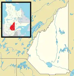 Lac-Moncouche Location in Saguenay–Lac-Saint-Jean Quebec. | |
| Coordinates: 47°57′N 71°58′W / 47.950°N 71.967°W[1] | |
| Country | |
| Province | |
| Region | Saguenay–Lac-Saint-Jean |
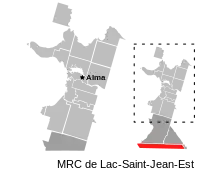
| RCM | Lac-Saint-Jean-Est |
| Constituted | January 1, 1986 |
| Government | |
| • Federal riding | Roberval—Lac-Saint-Jean |
| • Prov. riding | Lac-Saint-Jean |
| Area | |
| • Total | 260.20 km2 (100.46 sq mi) |
| • Land | 264.90 km2 (102.28 sq mi) |
| There is an apparent contradiction between two authoritative sources | |
| Population (2011)[3] | |
| • Total | 0 |
| • Density | 0.0/km2 (0/sq mi) |
| • Pop 2006-2011 | |
| • Dwellings | 0 |
| Time zone | UTC-5 (EST) |
| • Summer (DST) | UTC-4 (EDT) |
| Highways | |
Lac-Moncouche is an unorganized territory in the Canadian province of Quebec, located in the regional county municipality of Lac-Saint-Jean-Est. It had a population of 0 in the Canada 2011 Census and covers a land area of 264.90 km2, entirely within the Laurentides Wildlife Reserve.
See also
References
- ↑ "Banque de noms de lieux du Québec: Reference number 149590". toponymie.gouv.qc.ca (in French). Commission de toponymie du Québec.
- 1 2 Ministère des Affaires municipales, des Régions et de l'Occupation du territoire - Répertoire des municipalités: Lac-Moncouche
- 1 2 "Lac-Moncouche census profile". 2011 Census data. Statistics Canada. Retrieved 2010-10-28.
Adjacent Municipal Subdivisions | ||||||||||||||||
|---|---|---|---|---|---|---|---|---|---|---|---|---|---|---|---|---|
| ||||||||||||||||
| Cities | |
|---|---|
| Municipalities | |
| Parishes | |
| Villages | |
| Unorganized territories | |
| |
This article is issued from Wikipedia. The text is licensed under Creative Commons - Attribution - Sharealike. Additional terms may apply for the media files.