| Lackavrea | |
|---|---|
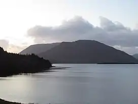 Lackavrea from the east with Corcogemore, and the full Maumturks range behind it. | |
| Highest point | |
| Elevation | 396 m (1,299 ft)[1] |
| Prominence | 301 m (988 ft)[1] |
| Listing | Marilyn |
| Coordinates | 53°29′10″N 9°31′55″W / 53.486062°N 9.531986°W[1] |
| Naming | |
| Native name | Leic Aimhréidh (Irish) |
| English translation | rugged rock-slab |
| Geography | |
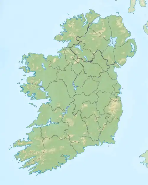 Lackavrea Location in Ireland | |
| Location | County Galway, Ireland |
| Parent range | Maumturks |
| OSI/OSNI grid | L983495 |
| Topo map | OSi Discovery 45[1] |
| Geology | |
| Mountain type | Pale quartzites, grits, graphitic top[1] |
Lackavrea (Irish: Leic Aimhréidh; rugged rock-slab)[2][3] is a 396-metre (1,299 ft) isolated mountain in County Galway, Ireland. It is located to the east of the larger Maumturks range, which lies within the Connemara region.[1]
See also
References
- 1 2 3 4 5 6 "Lackavrea". MountainViews. Retrieved 2 June 2019.
- ↑ Placenames Database of Ireland
- ↑ Paul Tempan (February 2012). "Irish Hill and Mountain Names" (PDF). MountainViews.ie.
External links
| British Isles |  | |
|---|---|---|
| Scotland | ||
| Outside Scotland | ||
| England | ||
| Ireland | ||
| County tops | ||
Mountains and hills of Connacht | |||||||
|---|---|---|---|---|---|---|---|
| Achill Island |  | ||||||
| Dartry Mountains | |||||||
| Maumturks | |||||||
| Mweelrea Mountains | |||||||
| Nephin Range | |||||||
| Ox Mountains | |||||||
| Partry Mountains | |||||||
| Sheeffry Range | |||||||
| Benna Beola |
| ||||||
| Others | |||||||
This article is issued from Wikipedia. The text is licensed under Creative Commons - Attribution - Sharealike. Additional terms may apply for the media files.