| Lake Gribben | |
|---|---|
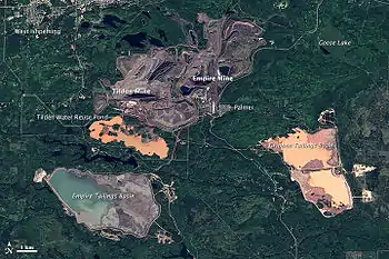 Lake Gribben is on the far right, 2013 (Landsat 8 photo) | |
 Lake Gribben | |
| Location | Palmer, Marquette County, Michigan, United States |
| Coordinates | 46°25′07″N 87°32′19″W / 46.41861°N 87.53861°W |
| Type | Lake |
| Basin countries | United States |
| Max. length | 3 mi (4.8 km) |
| Max. width | 1.5 mi (2.4 km) |
| Surface elevation | 1,211 feet (369 m)[1] |
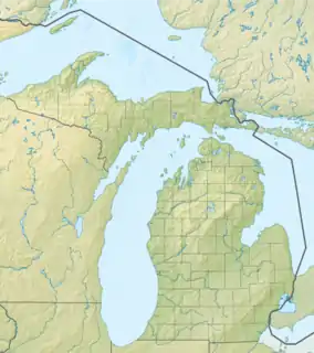
Lake Gribben is a lake in the U.S. state of Michigan, located one mile (1.6 km) southeast of the unincorporated community of Palmer. The lake exhibits a distinct orange hue due to its use as a tailings basin in association with open-pit mining operations of the Empire[2] and Tilden iron mines.[3]
See also
References
- ↑ U.S. Geological Survey Geographic Names Information System: Lake Gribben
- ↑ "No Shutdown for Mother Nature: Earth Image of the Week". Earthweek.com. October 11, 2013. Retrieved April 4, 2015.
- ↑ Schaetzl, Randall (n.d.). "The Tilden Mine". Michigan State University Department of Geology. Retrieved April 4, 2015.
This article is issued from Wikipedia. The text is licensed under Creative Commons - Attribution - Sharealike. Additional terms may apply for the media files.