Latour-en-Woëvre | |
|---|---|
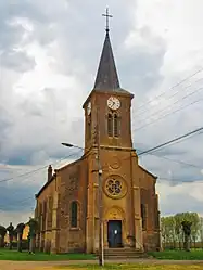 The church in Latour-en-Woëvre | |
.svg.png.webp) Coat of arms | |
Location of Latour-en-Woëvre | |
 Latour-en-Woëvre  Latour-en-Woëvre | |
| Coordinates: 49°05′19″N 5°48′56″E / 49.0886°N 5.8156°E | |
| Country | France |
| Region | Grand Est |
| Department | Meuse |
| Arrondissement | Verdun |
| Canton | Étain |
| Intercommunality | Territoire de Fresnes-en-Woëvre |
| Government | |
| • Mayor (2020–2026) | Claude Jamin[1] |
| Area 1 | 6.74 km2 (2.60 sq mi) |
| Population | 91 |
| • Density | 14/km2 (35/sq mi) |
| Time zone | UTC+01:00 (CET) |
| • Summer (DST) | UTC+02:00 (CEST) |
| INSEE/Postal code | 55281 /55160 |
| Elevation | 196–219 m (643–719 ft) (avg. 215 m or 705 ft) |
| 1 French Land Register data, which excludes lakes, ponds, glaciers > 1 km2 (0.386 sq mi or 247 acres) and river estuaries. | |
Latour-en-Woëvre (French pronunciation: [latuʁ ɑ̃ wavʁ]) is a commune in the Meuse department in Grand Est in north-eastern France.
Since 2015 it has been twinned with the village Rainhill in the United Kingdom.
See also
References
- ↑ "Répertoire national des élus: les maires". data.gouv.fr, Plateforme ouverte des données publiques françaises (in French). 2 December 2020.
- ↑ "Populations légales 2021". The National Institute of Statistics and Economic Studies. 28 December 2023.
Wikimedia Commons has media related to Latour-en-Woëvre.
This article is issued from Wikipedia. The text is licensed under Creative Commons - Attribution - Sharealike. Additional terms may apply for the media files.