Latrop | |
|---|---|
.jpg.webp) | |
Location of Latrop | |
 Latrop 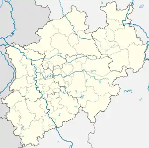 Latrop | |
| Coordinates: 51°6′44″N 8°19′34″E / 51.11222°N 8.32611°E | |
| Country | Germany |
| State | North Rhine-Westphalia |
| Admin. region | Arnsberg |
| District | Hochsauerlandkreis |
| Town | Schmallenberg |
| Elevation | 430 m (1,410 ft) |
| Population (2021-12-31) | |
| • Total | 176 |
| Time zone | UTC+01:00 (CET) |
| • Summer (DST) | UTC+02:00 (CEST) |
Latrop is a locality in the municipality Schmallenberg in the High Sauerland District in North Rhine-Westphalia, Germany.
The village has 176 inhabitants[1] and lies in the south of the municipality of Schmallenberg at a height of around 430 m. The river Latrop flows through the village. Latrop borders on the villages of Grafschaft, Störmecke, Schanze, Jagdhaus, Waidmannsruh and Fleckenberg.
In 1257 a Johannes von Latroph was named for the first time in a document. The village used to belong to the municipality of Grafschaft in Amt Schmallenberg until the end of 1974.[2]
Latrop was awarded gold for its beauty in the national competition “Our village has a future”.
Gallery
_vom_Dombaumeister_zu_Aachen_(Prof._Josef_Buchkremer)_-_panoramio_(1).jpg.webp) Chapel St. Josef
Chapel St. Josef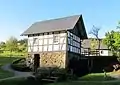 Old watermill
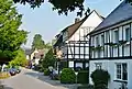 Street in Latrop
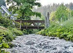 River Latrop
External links
References
- ↑ Schmallenberg.de: Inhabitants (in German)
- ↑ Statistisches Bundesamt (Hrsg.): Historisches Gemeindeverzeichnis für die Bundesrepublik Deutschland. Namens-, Grenz- und Schlüsselnummernänderungen bei Gemeinden, Kreisen und Regierungsbezirken vom 27.5.1970 bis 31.12.1982. W. Kohlhammer, Stuttgart/Mainz 1983, ISBN 3-17-003263-1, S. 335 f.
This article is issued from Wikipedia. The text is licensed under Creative Commons - Attribution - Sharealike. Additional terms may apply for the media files.