Le Plessis-Grimoult | |
|---|---|
Part of Les Monts d'Aunay | |
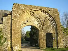 Abbey ruins | |
.svg.png.webp) Coat of arms | |
Location of Le Plessis-Grimoult | |
 Le Plessis-Grimoult  Le Plessis-Grimoult | |
| Coordinates: 48°57′43″N 0°36′30″W / 48.9619°N 0.6083°W | |
| Country | France |
| Region | Normandy |
| Department | Calvados |
| Arrondissement | Vire |
| Canton | Condé-en-Normandie |
| Commune | Les Monts d'Aunay |
| Area 1 | 16.15 km2 (6.24 sq mi) |
| Population (2019)[1] | 327 |
| • Density | 20/km2 (52/sq mi) |
| Time zone | UTC+01:00 (CET) |
| • Summer (DST) | UTC+02:00 (CEST) |
| Postal code | 14770 |
| Elevation | 200–361 m (656–1,184 ft) (avg. 300 m or 980 ft) |
| 1 French Land Register data, which excludes lakes, ponds, glaciers > 1 km2 (0.386 sq mi or 247 acres) and river estuaries. | |
Le Plessis-Grimoult (French pronunciation: [lə plɛsi ɡʁimu] ⓘ) is a former commune in the Calvados department in the Normandy region in northwestern France. On 1 January 2017, it was merged into the new commune Les Monts d'Aunay.[2]
Population
| Year | Pop. | ±% |
|---|---|---|
| 1800 | 820 | — |
| 1851 | 757 | −7.7% |
| 1881 | 660 | −12.8% |
| 1911 | 515 | −22.0% |
| 1931 | 402 | −21.9% |
| 1946 | 396 | −1.5% |
| 1954 | 327 | −17.4% |
| 1962 | 370 | +13.1% |
| 1968 | 358 | −3.2% |
| 1975 | 331 | −7.5% |
| 1982 | 300 | −9.4% |
| 1990 | 292 | −2.7% |
| 1999 | 310 | +6.2% |
| 2008 | 352 | +13.5% |
See also
References
- ↑ Téléchargement du fichier d'ensemble des populations légales en 2019, INSEE
- ↑ Arrêté préfectoral 26 September 2016 (in French)
Wikimedia Commons has media related to Le Plessis-Grimoult.
This article is issued from Wikipedia. The text is licensed under Creative Commons - Attribution - Sharealike. Additional terms may apply for the media files.