Lubbeek | |
|---|---|
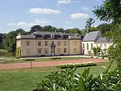 | |
 Flag  Coat of arms | |
Location of Lubbeek | |
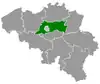
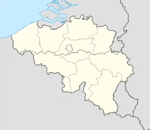 Lubbeek Location in Belgium
Location of Lubbeek in Flemish Brabant 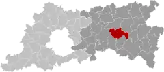 | |
| Coordinates: 50°52′54″N 04°50′29″E / 50.88167°N 4.84139°E | |
| Country | |
| Community | Flemish Community |
| Region | Flemish Region |
| Province | Flemish Brabant |
| Arrondissement | Leuven |
| Government | |
| • Mayor | Theo Francken (N-VA) |
| • Governing party/ies | N-VA, CD&V |
| Area | |
| • Total | 45.28 km2 (17.48 sq mi) |
| Population (2018-01-01)[1] | |
| • Total | 14,393 |
| • Density | 320/km2 (820/sq mi) |
| Postal codes | 3210-3212 |
| NIS code | 24066 |
| Area codes | 016 |
| Website | www.lubbeek.be |
Lubbeek (Dutch pronunciation: [ˈlʏbeːk]) is a municipality located in the Belgian province of Flemish Brabant. The municipality comprises the towns of Binkom, Linden, Lubbeek proper and Pellenberg. On January 1, 2006, Lubbeek had a total population of 13,660. The total area is 46.13 km² which gives a population density of 296 inhabitants per km². It is a part of the police zone Bierbeek-Boutersem-Holsbeek-Lubbeek.[2] The inventory of Flemish heritage sites lists a number of sites as heritage sites in Lubbeek including a number of former windmills, churches, mansions and homes.[3]
References
- ↑ "Wettelijke Bevolking per gemeente op 1 januari 2018". Statbel. Retrieved 9 March 2019.
- ↑ "Startpagina | Lokale Politie Bierbeek / Boutersem / Holsbeek / Lubbeek". www.politie.be. Retrieved 2023-04-24.
- ↑ "Lubbeek". inventaris.onroerenderfgoed.be (in Dutch). Retrieved 2023-04-24.
External links
 Media related to Lubbeek at Wikimedia Commons
- Official website - Available only in Dutch
This article is issued from Wikipedia. The text is licensed under Creative Commons - Attribution - Sharealike. Additional terms may apply for the media files.