Lurganare
| |
|---|---|
| Village | |
 Housing in Lurganare | |
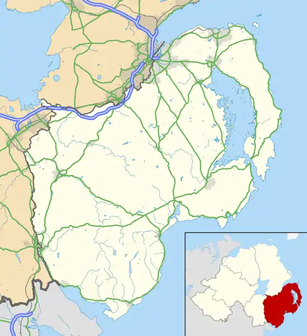 Lurganare Location within County Down | |
| District | |
| County | |
| Country | Northern Ireland |
| Sovereign state | United Kingdom |
| Postcode district | BT34 |
| Police | Northern Ireland |
| Fire | Northern Ireland |
| Ambulance | Northern Ireland |
Lurganare (from Irish Lorga an Áir, meaning 'tract of the slaughter')[1] is a small village and townland in County Down, Northern Ireland, four miles north of Newry. It had a population of 195 at the 2001 census.[2] It lies within the Newry, Mourne and Down District Council area.[2] The local primary school, St Mary's Primary School, had an enrolment of 118 pupils as of 2011.[3]
See also
References
- ↑ Placenames NI Archived 2012-03-31 at the Wayback Machine
- 1 2 "Jerrettspass & Lurganare Cluster - Village Renewal and Development Plans" (PDF). newrymournedown.org. Newry, Mourne and Down District Council. July 2012. Retrieved 6 January 2024.
- ↑ "Primary Inspection Report - St Mary's Primary School, Newry" (PDF). Education and Training Inspectorate. November 2011. Retrieved 12 January 2024.
St Mary's Primary School is situated in Lurganare about six miles from the centre of Newry [..] The enrolment has increased [..] to the current figure of 118
This article is issued from Wikipedia. The text is licensed under Creative Commons - Attribution - Sharealike. Additional terms may apply for the media files.