Mafinga
Mji wa Mafinga | |
|---|---|
.jpg.webp) Tuamini farmers in Mafinga, Tanzania | |
 Mafinga Town District of Iringa Region | |
| Coordinates: 8°17′48″S 35°17′45″E / 8.29677105°S 35.29576776°E | |
| Country | |
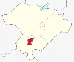
| Region | Iringa Region |
| Government | |
| • Type | Council |
| Area | |
| • Total | 953 km2 (368 sq mi) |
| Elevation | 1,871 m (6,138 ft) |
| Population (2016) | |
| • Total | 74,963 |
| • Density | 79/km2 (200/sq mi) |
| Time zone | UTC+3 (EAT) |
| Website | District Website |
Mafinga Town Council is one of the five districts of the Iringa Region of Tanzania.[1][2]
In 2016, the Tanzania National Bureau of Statistics report there were 74,963 people in the town; this is up from 51,902 in 2012.[3][4]
References
- ↑ Population Distribution by Administrative Units, United Republic of Tanzania, 2013 Archived 2013-05-02 at the Wayback Machine
- ↑ "Tanzania: Administrative Division". City Population. Retrieved 29 December 2018.
- ↑ 2012 Population and Housing Census - Population Distribution by Administrative Areas (PDF) (Report). Dar es Salaam, Tanzania: National Bureau of Statistics. 1 March 2013. Archived (PDF) from the original on 26 March 2022. Retrieved 3 July 2022.
- ↑ 2016 Makadirio ya Idadi ya Watu katika Majimbo ya Uchaguzi kwa Mwaka 2016, Tanzania Bara [Population Estimates in Administrative Areas for the Year 2016, Mainland Tanzania] (PDF) (Report) (in Swahili). Dar es Salaam, Tanzania: National Bureau of Statistics. 1 April 2016. Archived (PDF) from the original on 27 December 2021. Retrieved 3 July 2022.
This article is issued from Wikipedia. The text is licensed under Creative Commons - Attribution - Sharealike. Additional terms may apply for the media files.