Maheshwar
মহেশ্বর | |
|---|---|
Village | |
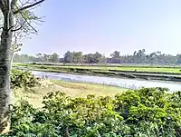 Baniyadaha River During Winter Season 2023. | |
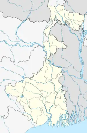 Maheshwar Location in West Bengal, India  Maheshwar Maheshwar (India) | |
| Coordinates: 26°2′46.66″N 89°29′29.84″E / 26.0462944°N 89.4916222°E | |
| Country | |
| State | West Bengal |
| District | Cooch Behar |
| Government | |
| • Type | Panchayat |
| • Body | Okrabari Gram Panchayat |
| Area | |
| • Total | 99.7 ha (246.4 acres) |
| Population (2011) | |
| • Total | 1,393 |
| • Density | 1,400/km2 (3,600/sq mi) |
| Language | |
| • Official | Bengali, English |
| Time zone | UTC+5:30 (IST) |
| PIN | 736135 |
| Telephone/STD code | 03581 |
| Vehicle registration | WB 64 |
| Lok Sabha constituency | Cooch Behar |
| Vidhan Sabha constituency | Sitai |
| Website | coochbehar |
Maheshwar (Bengali: মহেশ্বর) is a village of Dinhata-I CD block, Dinhata sub-division in Cooch Behar district of West Bengal, a state of India.[1][2]
Demographics
According to the 2011 Census of India, Maheshwar had a total population of 1393, of which 745 (53%) were males and 648 (47%) were females. The population in the age range 0–6 years of age was 193. The total number of literate persons in Maheshwar is 878 (63%). The village consists of 311 households families.[3][4]
| Particulars | Total | Male | Female |
|---|---|---|---|
| Total no. of houses | 331 | - | - |
| Population | 1,393 | 745 | 648 |
| Child (0–6) | 193 | 116 | 77 |
| Literacy Rate | 73.17% | 79.81% | 65.85% |
Transport
The village is 15 km away from city Dinhata. And nearly 40 km away from district head quarter of Cooch Behar district.[5]
Education
There is only two educational institute for Primary Education.
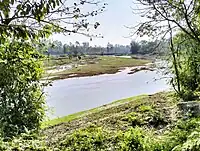
Baniyadaha River During Winter Season 2023
See also
References
- ↑ Census of India, 1991: Kochbihar. Controller, Government Print., West Bengal. 1997.
- ↑ "Villages of Cooch Behar". Coochbehar.nic.in. Archived from the original on 2 August 2020. Retrieved 30 October 2023.
- ↑ "2011 Census – Primary Census Abstract Data Tables". West Bengal – District-wise. Registrar General and Census Commissioner, India. Archived from the original on 9 October 2015. Retrieved 11 March 2017.
- ↑ "Maheshwar Population - Koch Bihar, West Bengal". Retrieved 31 October 2023.
- ↑ "District Census Handbook Koch Bihar, Series 20 Part XII A, Census of India 2011" (PDF). Page 423: Map of Dinhata-I CD Block. Directorate of Census Operations 2011. Archived from the original (PDF) on 14 November 2016. Retrieved 11 March 2017.
- ↑ "Maheswar 5th Plan Primary School". Banglar Shiksha. Retrieved 30 October 2023.
- ↑ "Maheswar Shishu Shiksha Kendra". Banglar Shiksha. Retrieved 30 October 2023.
Cities and towns in Cooch Behar district | |||||||||||
|---|---|---|---|---|---|---|---|---|---|---|---|
| Cities, municipal and census towns |
| ||||||||||
| Locations other than cities and towns |
| ||||||||||
| Related topics |
| ||||||||||
This article is issued from Wikipedia. The text is licensed under Creative Commons - Attribution - Sharealike. Additional terms may apply for the media files.